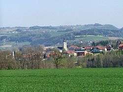
Waizenkirchen
| Waizenkirchen | ||
|---|---|---|
 | ||
| ||
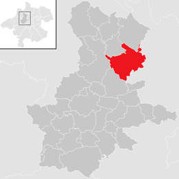
 Waizenkirchen Location within Austria
Location in the district
| ||
| Coordinates: 48°19′49″N 13°51′30″E / 48.33028°N 13.85833°ECoordinates: 48°19′49″N 13°51′30″E / 48.33028°N 13.85833°E | ||
| Country | Austria | |
| State | Upper Austria | |
| District | Grieskirchen | |
| Government | ||
| • Mayor | Josef Dopler (ÖVP) | |
| Area | ||
| • Total | 34.2 km2 (13.2 sq mi) | |
| Elevation | 367 m (1,204 ft) | |
| Population (14 June 2016)[1] | ||
| • Total | 3,650 | |
| • Density | 110/km2 (280/sq mi) | |
| Time zone | UTC+1 (CET) | |
| • Summer (DST) | UTC+2 (CEST) | |
| Postal code | 4730 | |
| Area code | 07277 | |
| Vehicle registration | GR | |
| Website | www.waizenkirchen.at | |

Waizenkirchen is a municipality in the district of Grieskirchen in the Austrian state of Upper Austria.
Geography
Waizenkirchen lies in the Hausruckviertel. About 10 percent of the municipality is forest, and 80 percent is farmland.
History
On May 4, 1945, when a parked tank at the 1st Battalion Command Post caught fire, putting nearby vehicles at risk from flames and exploding ammunition, Technician 5th Grade Eugene B. Spade from Major General Stanley Eric Reinhart's 261st Infantry Regiment raced through bursting 90-mm shells and .50 caliber cartridges to prevent a disaster.
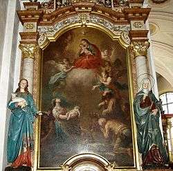
Mary, Help of Christians, Saints Peter and Paul Parish Church, Waizenkirchen
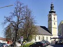
Parish Church
References
| Wikimedia Commons has media related to Waizenkirchen. |
This article is issued from
Wikipedia.
The text is licensed under Creative Commons - Attribution - Sharealike.
Additional terms may apply for the media files.