Warta
| Warta River | |
|---|---|
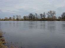
 Warta River near Wronki | |
| Country | Poland |
| Physical characteristics | |
| Main source |
Kromołów, part of Zawiercie, Kraków-Częstochowa Upland 379 m (1,243 ft) |
| River mouth |
Oder River at Kostrzyn 52°35′55″N 14°36′37″E / 52.5986°N 14.6103°ECoordinates: 52°35′55″N 14°36′37″E / 52.5986°N 14.6103°E |
| Length | 795 km (494 mi) |
| Discharge |
|
| Basin features | |
| Progression | Oder→ Baltic Sea |
| Basin size | 54,520 km2 (21,050 sq mi) |
The Warta (Polish pronunciation: [ˈvaɾta] German: Warthe; Latin: Varta) is a river in western-central Poland and a tributary of the Oder. With a length of approximately 795 kilometres (494 mi), it is the country's second-longest river located within its borders and third-longest in terms of total length.[1] The Warta has a basin area of 54,520 square kilometers (21,050 sq mi)[1] and it is navigable from Kostrzyn nad Odrą to Konin, approximately half of its length.[2] It is connected to the Vistula by the Noteć River and the Bydgoszcz Canal (Kanał Bydgoski) near the city of Bydgoszcz.
Course
It rises in the Kraków-Częstochowa Upland at Kromołów in Zawiercie, Silesian Voivodeship, flows through Łódź Land, Greater Poland and Lubusz Land, where it empties into the Oder near Kostrzyn at the border with Germany.
The Greater Polish Warta Basin was the original Poland; it is said that the Polans (Polish: Polanie), a West Slavic tribe, settled the Warta Basin in the 8th century. The river is also mentioned in the second stanza of the Polish national anthem, "Poland Is Not Yet Lost."
Cities
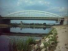 Warta River in Poznań |
Right tributaries
Left tributaries
See also
| Wikimedia Commons has media related to Warta. |
References
Tributaries of the Oder / Odra | ||
|---|---|---|
| Main tributaries of the left bank |
| 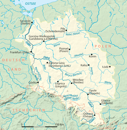 |
| Main tributaries of the right bank |
| |
| Distributary | ||
| Cities | ||
| Authority control |
|---|