Opava (river)
| Opava | |
|---|---|
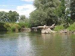 The Opava near Háj ve Slezsku | |
| Country | Czech Republic, Poland |
| Physical characteristics | |
| Main source |
Hrubý Jeseník 520 meters (1,710 ft) 50°07′33″N 17°22′47″E / 50.1257°N 17.3796°E |
| River mouth |
Oder 49°50′01″N 18°13′16″E / 49.8336°N 18.2212°ECoordinates: 49°50′01″N 18°13′16″E / 49.8336°N 18.2212°E |
| Length | 110.7 km (68.8 mi) |
| Basin features | |
| Progression | Oder→ Baltic Sea |
| Basin size | 2,090 km2 (810 sq mi) |
The Opava (Czech: Opava, Polish: Opawa, German: Oppa) is a river in the north-eastern Czech Republic, a left tributary of the Oder river. It originates at the confluence of Bílá (White), Střední (Middle) and Černá (Black) Opava in Vrbno pod Pradědem and runs over 110 km (69 mi) to the Oder at Ostrava, with some 25 km (16 mi) forming the border with Poland. Its basin area is about 2,090 km2, of which 1,814 km2 in the Czech Republic.[1]
After the 1742 First Silesian War the Opava river in the Duchy of Troppau by the terms of the Treaty of Breslau became the border between Austrian and Prussian Silesia (the later Province of Silesia). After World War I the demarcation was confirmed by the 1919 Treaty of Saint-Germain-en-Laye as the border between Czechoslovakia (Czech Silesia) and the Second Polish Republic.
Towns
References
- ↑ "Charakteristiky toků a povodí ČR - Opava" (in Czech). VÚV TGM. Retrieved 2018-05-08.
Tributaries of the Oder / Odra | ||
|---|---|---|
| Main tributaries of the left bank |
| 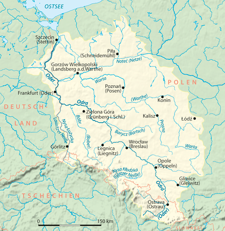 |
| Main tributaries of the right bank |
| |
| Distributary | ||
| Cities | ||
| Authority control |
|---|