Warren Township, St. Joseph County, Indiana
| Warren Township | |
|---|---|
| Township | |
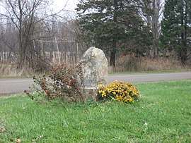 Monument on Redwood Road at the Michigan border | |
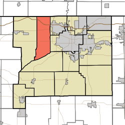 Location in St. Joseph County | |
| Coordinates: 41°41′28″N 86°22′59″W / 41.69111°N 86.38306°WCoordinates: 41°41′28″N 86°22′59″W / 41.69111°N 86.38306°W | |
| Country |
|
| State |
|
| County | St. Joseph |
| Government | |
| • Type | Indiana township |
| Area | |
| • Total | 32.95 sq mi (85.34 km2) |
| • Land | 32.11 sq mi (83.16 km2) |
| • Water | 0.84 sq mi (2.18 km2) 2.55% |
| Elevation[1] | 722 ft (220 m) |
| Population (2000) | |
| • Total | 6,430 |
| • Density | 200.2/sq mi (77.3/km2) |
| Time zone | UTC-5 (Eastern (EST)) |
| • Summer (DST) | UTC-4 (EDT) |
| ZIP codes | 46552, 46554, 46619, 46628 |
| Area code(s) | 574 |
| GNIS feature ID | 453978 |
Warren Township is one of thirteen townships in St. Joseph County, in the U.S. state of Indiana.[2] As of the 2000 census, its population was 6,430.[3]
Geography
According to the United States Census Bureau, Warren Township covers an area of 32.95 square miles (85.3 km2); of this, 32.11 square miles (83.2 km2) (97.45 percent) is land and 0.84 square miles (2.2 km2) (2.55 percent) is water.
Cities, towns, villages
- South Bend (partial)
Unincorporated towns
- Chain-O-Lakes at 41°42′30″N 86°22′48″W / 41.70838°N 86.380012°W
- Crumstown at 41°37′27″N 86°24′29″W / 41.624213°N 86.408068°W
- Lydick at 41°41′36″N 86°22′48″W / 41.69338°N 86.380012°W
- Westfield at 41°40′32″N 86°22′49″W / 41.675602°N 86.38029°W
(This list is based on USGS data and may include former settlements.)
Adjacent townships
- Bertrand Township, Berrien County, Michigan (north)
- German Township (northeast)
- Portage Township (east)
- Greene Township (south)
- Olive Township (west)
Major highways
Airports and landing strips
- Chain-O-Lakes Airport
Lakes
- Bass Lake
- Chamberlain Lake
- Mud Lake
- South Clear Lake
- Szmanda Lake
School districts
- South Bend Community School Corporation
Political districts
- Indiana's 2nd congressional district
- State House District 8
- State Senate District 8
References
- United States Census Bureau 2008 TIGER/Line Shapefiles
- United States Board on Geographic Names (GNIS)
- IndianaMap
- ↑ "US Board on Geographic Names". United States Geological Survey. October 25, 2007. Retrieved 2017-05-09.
- ↑ "Warren Township". Geographic Names Information System. United States Geological Survey. Retrieved 2009-07-07.
- ↑ United States Census Bureau American FactFinder
External links
Places adjacent to Warren Township, St. Joseph County, Indiana | |
|---|---|
Municipalities and communities of St. Joseph County, Indiana, United States | ||
|---|---|---|
| Cities | ||
| Towns | ||
| Townships | ||
| CDPs | ||
| Unincorporated communities |
| |
| Footnotes | ‡This populated place also has portions in an adjacent county or counties | |
This article is issued from
Wikipedia.
The text is licensed under Creative Commons - Attribution - Sharealike.
Additional terms may apply for the media files.