Centre Township, St. Joseph County, Indiana
| Centre Township | |
|---|---|
| Township | |
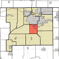 Location in St. Joseph County | |
| Coordinates: 41°37′31″N 86°15′01″W / 41.62528°N 86.25028°WCoordinates: 41°37′31″N 86°15′01″W / 41.62528°N 86.25028°W | |
| Country |
|
| State |
|
| County | St. Joseph |
| Government | |
| • Type | Indiana township |
| Area | |
| • Total | 19.35 sq mi (50.11 km2) |
| • Land | 19.33 sq mi (50.07 km2) |
| • Water | 0.01 sq mi (0.03 km2) 0.06% |
| Elevation[1] | 827 ft (252 m) |
| Population (2000) | |
| • Total | 14,236 |
| • Density | 736.5/sq mi (284.3/km2) |
| Time zone | UTC-5 (Eastern (EST)) |
| • Summer (DST) | UTC-4 (EDT) |
| ZIP code | 46614 |
| Area code(s) | 574 |
| GNIS feature ID | 452853 |
Centre Township is one of thirteen townships in St. Joseph County, in the U.S. state of Indiana.[2] As of the 2000 census, its population was 14,236.[3]
Geography
According to the United States Census Bureau, Centre Township covers an area of 19.35 square miles (50.1 km2); of this, 19.33 square miles (50.1 km2) (99.92 percent) is land and 0.01 square miles (0.026 km2) (0.06 percent) is water.
Cities, towns, villages
- Gulivoire Park
- South Bend (partial)
Unincorporated towns
- Crest Manor Addition at 41°36′59″N 86°14′00″W / 41.616437°N 86.233339°W
- Gilmer Park at 41°37′11″N 86°15′06″W / 41.61977°N 86.251673°W
- Miami Trails Addition at 41°35′56″N 86°14′10″W / 41.598937°N 86.236117°W
- Nutwood at 41°35′38″N 86°16′55″W / 41.593936°N 86.281952°W
- Orchard Heights Addition at 41°36′06″N 86°14′23″W / 41.601715°N 86.239728°W
(This list is based on USGS data and may include former settlements.)
Adjacent townships
- Portage Township (north)
- Penn Township (east)
- Madison Township (southeast)
- Union Township (south)
- Greene Township (west)
Cemeteries
The township contains these four cemeteries: Mount Calvary, Southlawn, Southlawn and Van Buskirk.
Major highways
Landmarks
- Erskine Plaza
- Evergreen Hill was listed on the National Register of Historic Places in 2001.[4]
School districts
- South Bend Community School Corporation
Political districts
- Indiana's 2nd congressional district
- State House District 6
- State House District 7
- State Senate District 9
References
- United States Census Bureau 2008 TIGER/Line Shapefiles
- United States Board on Geographic Names (GNIS)
- IndianaMap
- ↑ "US Board on Geographic Names". United States Geological Survey. October 25, 2007. Retrieved 2017-05-09.
- ↑ "Centre Township". Geographic Names Information System. United States Geological Survey. Retrieved 2009-07-07.
- ↑ United States Census Bureau American FactFinder
- ↑ National Park Service (2010-07-09). "National Register Information System". National Register of Historic Places. National Park Service.
External links
Places adjacent to Centre Township, St. Joseph County, Indiana | ||||||||||
|---|---|---|---|---|---|---|---|---|---|---|
| ||||||||||
Municipalities and communities of St. Joseph County, Indiana, United States | ||
|---|---|---|
| Cities | ||
| Towns | ||
| Townships | ||
| CDPs | ||
| Unincorporated communities |
| |
| Footnotes | ‡This populated place also has portions in an adjacent county or counties | |
This article is issued from
Wikipedia.
The text is licensed under Creative Commons - Attribution - Sharealike.
Additional terms may apply for the media files.