Warawa
| Warawa | |
|---|---|
| LGA and town | |
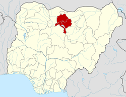
 Warawa Location in Nigeria | |
| Coordinates: 11°53′N 8°41′E / 11.883°N 8.683°ECoordinates: 11°53′N 8°41′E / 11.883°N 8.683°E | |
| Country |
|
| State | Kano State |
| Area | |
| • Total | 360 km2 (140 sq mi) |
| Population (2006 census) | |
| • Total | 128,787 |
| • Ethnicities | Hausa (Majority) and Fulani (Minority) |
| • Religions | Islam |
| Time zone | UTC+1 (WAT) |
| 3-digit postal code prefix | 713 |
| ISO 3166 code | NG.KN.WA |
Warawa is a Local Government Area in Kano State, Nigeria. Its headquarters are in the town of Warawa on the A237 highway. It was created out of Dawakin Kudu Local Government in the early 90s. Hausa people make up about 90 per cent of the total population of the Local Government Area.
KannyWood comedian/actor Rabilu Musa (Ibro) was from the local government.
The council is led by a chairman who is the executive head of the local government. The Warawa legislative council make laws governing Warawa local government area. It consists of 15 Councillors representing the 15 wards of the local government area. The 15 wards of Warawa local government area are:
- Yan dalla
- Yangizo
- Amarawa
- Danlasan
- Garin Dau
- Gogel
- Imawa
- J/Galadima
- Jemagu
- Jigawa
- Katarkawa
- Madari Mata
- Tamburawar Gabas
- Tangar
- Warawa
It has an area of 360 km² and a population of 128,787 at the 2006 census.
The postal code of the area is 713.[1]
References
- ↑ "Post Offices- with map of LGA". NIPOST. Retrieved 2009-10-20.
State capital: Kano | ||
| Local government areas |
|  |