Nasarawa, Kano State
| Nassarawa | |
|---|---|
| LGA | |
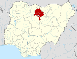
 Nassarawa Location in Nigeria | |
| Coordinates: 11°58′37″N 8°33′45″E / 11.97694°N 8.56250°ECoordinates: 11°58′37″N 8°33′45″E / 11.97694°N 8.56250°E | |
| Country |
|
| State | Kano State |
| Area | |
| • Total | 34 km2 (13 sq mi) |
| Population (2006 census) | |
| • Total | 596,669 |
| Time zone | UTC+1 (WAT) |
| 3-digit postal code prefix | 700 |
| ISO 3166 code | NG.KN.NA |
Nassarawa is a Local Government Area in Kano State, Nigeria. Its headquarters are in the locality of Bompai, within the city of Kano.
It has an area of 34 km² and a population of 596,669 at the 2006 census.
The postal code of the area is 700.[1]
References
- ↑ "Post Offices- with map of LGA". NIPOST. Archived from the original on 2009-10-07. Retrieved 2009-10-20.
State capital: Kano | ||
| Local government areas |
|  |
This article is issued from
Wikipedia.
The text is licensed under Creative Commons - Attribution - Sharealike.
Additional terms may apply for the media files.