Takai
| Takai | |
|---|---|
| LGA and town | |
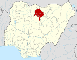
 Takai Location in Nigeria | |
| Coordinates: 11°35′N 9°07′E / 11.583°N 9.117°ECoordinates: 11°35′N 9°07′E / 11.583°N 9.117°E | |
| Country |
|
| State | Kano State |
| Area | |
| • Total | 598 km2 (231 sq mi) |
| Population (2006 census) | |
| • Total | 202,743 |
| Time zone | UTC+1 (WAT) |
| 3-digit postal code prefix | 712 |
| ISO 3166 code | NG.KN.TK |
Takai is a Local Government Area in Kano State, Nigeria. Its headquarters are in the town of Takai to the north of the area on the A237 highway.
It has an area of 598 km² and a population of 202,743 at the 2006 census.
The postal code of the area is 712.[1]
References
- ↑ "Post Offices- with map of LGA". NIPOST. Archived from the original on 2009-10-07. Retrieved 2009-10-20.
State capital: Kano | ||
| Local government areas |
|  |
This article is issued from
Wikipedia.
The text is licensed under Creative Commons - Attribution - Sharealike.
Additional terms may apply for the media files.