Kumbotso
| Kumbotso | |
|---|---|
| LGA and town | |
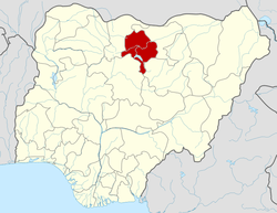
 Kumbotso Location in Nigeria | |
| Coordinates: 11°53′17″N 8°30′10″E / 11.88806°N 8.50278°ECoordinates: 11°53′17″N 8°30′10″E / 11.88806°N 8.50278°E | |
| Country |
|
| State | Kano State |
| Area | |
| • Total | 158 km2 (61 sq mi) |
| Population (2006 census) | |
| • Total | 295,979 |
| Time zone | UTC+1 (WAT) |
| 3-digit postal code prefix | 700 |
| ISO 3166 code | NG.KN.KT |
Kumbotso is a Local Government Area in Kano State, Nigeria. Its headquarters are in the town of Kumbotso.
It has an area of 158 km² and a population of 409,500 based on the 2016 population projection.[1]
The postal code of the area is 700.[2]
References
- ↑ "Kumbotso (Local Government Area, Nigeria) - Population Statistics, Charts, Map and Location". www.citypopulation.de. Retrieved 2018-03-06.
- ↑ "Post Offices- with map of LGA". NIPOST. Archived from the original on 2012-11-26. Retrieved 2009-10-20.
State capital: Kano | ||
| Local government areas |
|  |
This article is issued from
Wikipedia.
The text is licensed under Creative Commons - Attribution - Sharealike.
Additional terms may apply for the media files.