Wakefield Parish, New Brunswick
| Wakefield | |
|---|---|
| Parish | |
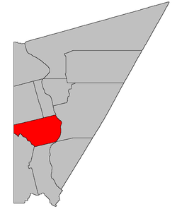 Location within Carleton County, New Brunswick | |
| Coordinates: 46°13′30″N 67°31′12″W / 46.225°N 67.52°W | |
| Country |
|
| Province |
|
| County | Carleton |
| Established | 1803 |
| Area[1] | |
| • Land | 196.57 km2 (75.90 sq mi) |
| Population (2011)[1] | |
| • Total | 2,814 |
| • Density | 14.3/km2 (37/sq mi) |
| • Pop 2006-2011 |
|
| • Dwellings | 1,147 |
| Time zone | UTC-4 (AST) |
| • Summer (DST) | UTC-3 (ADT) |
Wakefield is a Canadian parish in Carleton County, New Brunswick.[2]
Its population in the 2011 Census was 2,814.
History
Wakefield Parish was established in 1803 as part of York County and named for the city of Wakefield in Yorkshire County, England: Wakefield Parish included Simonds Parish until 1842, and Brighton Parish, York County, until 1830.
Delineation
Wakefield Parish is defined in the Territorial Division Act[3] as being bounded:
- North by the lower line of lot numbered thirty-eight, granted to David Good, and the westerly prolongation thereof; westerly by the County line; south by Woodstock and Richmond Parishes, and east by the Saint John River, including all the islands in front.
Communities
|
|
|
Demographics
PopulationPopulation trend[4]
|
LanguageMother tongue language (2006)[5]
|
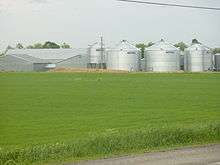
Farm in Jacksonville
See also
References
- 1 2 2011 Statistics Canada Census Profile: Wakefield Parish, New Brunswick
- ↑ New Brunswick Provincial Archives - Wakefield Parish
- ↑ "Territorial Division Act (R.S.N.B. 1973, c. T-3)". Government of New Brunswick website. Retrieved 30 August 2016.
- ↑ Statistics Canada: 1996, 2001, 2006 census
- ↑ 2006 Statistics Canada Community Profile: Wakefield Parish, New Brunswick
Places adjacent to Wakefield Parish, New Brunswick | |
|---|---|
| Subdivisions | |
|---|---|
| Cities | |
| Counties | |
| |
Coordinates: 46°13′30″N 67°31′12″W / 46.22500°N 67.52000°W
This article is issued from
Wikipedia.
The text is licensed under Creative Commons - Attribution - Sharealike.
Additional terms may apply for the media files.