Vlachova Lhota
| Vlachova Lhota | |||
|---|---|---|---|
| Municipality | |||
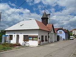 Municipal office | |||
| |||
 Vlachova Lhota | |||
| Coordinates: 49°9′7″N 17°57′17″E / 49.15194°N 17.95472°ECoordinates: 49°9′7″N 17°57′17″E / 49.15194°N 17.95472°E | |||
| Country |
| ||
| Region | Zlín | ||
| District | Zlín | ||
| Area | |||
| • Total | 3.82 km2 (1.47 sq mi) | ||
| Elevation | 452 m (1,483 ft) | ||
| Population (2006) | |||
| • Total | 243 | ||
| • Density | 64/km2 (160/sq mi) | ||
| Postal code | 766 01 | ||


Vlachova Lhota is a village and municipality (obec) in Zlín District in the Zlín Region of the Czech Republic.
The municipality covers an area of 3.82 square kilometres (1.47 sq mi), and has a population of 243 (as at 3 July 2006).
Vlachova Lhota lies approximately 23 kilometres (14 mi) south-east of Zlín and 276 km (171 mi) east of Prague.
References
| Wikimedia Commons has media related to Vlachova Lhota. |
This article is issued from
Wikipedia.
The text is licensed under Creative Commons - Attribution - Sharealike.
Additional terms may apply for the media files.