Lovendegem
| Lovendegem | |||
|---|---|---|---|
| Municipality | |||
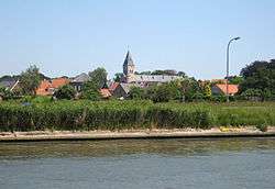 Lovendegem, seen across the Ghent-Bruges Canal | |||
| |||
 Lovendegem Location in Belgium
Location of Lovendegem in East Flanders 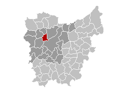 | |||
| Coordinates: 51°06′N 03°36′E / 51.100°N 3.600°ECoordinates: 51°06′N 03°36′E / 51.100°N 3.600°E | |||
| Country | Belgium | ||
| Community | Flemish Community | ||
| Region | Flemish Region | ||
| Province | East Flanders | ||
| Arrondissement | Ghent | ||
| Government | |||
| • Mayor | Christiaan De Wispelaere | ||
| • Governing party/ies | CD&V | ||
| Area | |||
| • Total | 19.48 km2 (7.52 sq mi) | ||
| Population (1 January 2017)[1] | |||
| • Total | 9,490 | ||
| • Density | 490/km2 (1,300/sq mi) | ||
| Postal codes | 9920, 9921 | ||
| Area codes | 09 | ||
| Website | www.lovendegem.be | ||

Lovendegem (Dutch pronunciation: [ˌloːˈvɛndəɣɛm]) is a municipality located in Flanders, one of the three regions of Belgium, and in the province of East Flanders. The municipality comprises the towns of Lovendegem proper and Vinderhoute.[2] On January 1, 2006, Lovendegem had a total population of 9,358. The total area is 19.48 km² which gives a population density of 480 inhabitants per square kilometer.
The name of the town was first recorded as Lovendenghiem in 1150,[3] but there are traces of human settlements back to the Iron Age.
The Ghent-Bruges Canal crosses the municipality, with the town of Lovendegem to the north of the canal, and Vinderhoute to the south.
Effective 1 January 2019, Waarschoot, Lovendegem and Zomergem will be merged into the new municipality of Lievegem.
Gallery
 Lovendegem, townhall
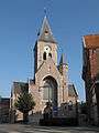 Lovendegem, church: Sint Martinuskerk
Famous inhabitants
- Maurice De Waele, cyclist, winner of the Tour de France
References
- ↑ Population per municipality as of 1 January 2017 (XLS; 397 KB)
- ↑ "Vinderhoute".
- ↑ "Lovendegem".
External links

- Official website (in Dutch)
Places adjacent to Lovendegem | ||||||||||
|---|---|---|---|---|---|---|---|---|---|---|
| ||||||||||