Berlare
| Berlare | |||
|---|---|---|---|
| Municipality | |||
 | |||
| |||
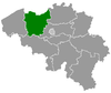
 Berlare Location in Belgium
Location of Berlare in East Flanders  | |||
| Coordinates: 51°01′N 04°00′E / 51.017°N 4.000°ECoordinates: 51°01′N 04°00′E / 51.017°N 4.000°E | |||
| Country | Belgium | ||
| Community | Flemish Community | ||
| Region | Flemish Region | ||
| Province | East Flanders | ||
| Arrondissement | Dendermonde | ||
| Government | |||
| • Mayor | Katja Gabriëls (Open VLD) | ||
| • Governing party/ies | Open VLD, sp.a | ||
| Area | |||
| • Total | 37.82 km2 (14.60 sq mi) | ||
| Population (1 January 2017)[1] | |||
| • Total | 14,785 | ||
| • Density | 390/km2 (1,000/sq mi) | ||
| Postal codes | 9290 | ||
| Area codes | 09, 052 | ||
| Website | www.berlare.be | ||


Berlare (Dutch pronunciation: [ˈbɛrlaːrə]) is a municipality located in the Belgian province of East Flanders. The municipality comprises the towns of Berlare proper, Overmere and Uitbergen, as well as the village Donk. The Donkmeer, a large lake and a regional tourist attraction, is located centrally in the municipality. On January 1, 2012, Berlare had a total population of 14,690.
History
It was where the 1798 rebellion against French rule, known as the "Peasants' War" began in 1798.
Places of interest
- The church of Saint Martin and a 17th-century pillory in the center of Berlare proper. The Castle of Berlare, also in the town center, was opened to the public in 2012.
- The Bareldonk Chapel, built in the 14th century and expanded in 1774 in Rococo style, is situated in Donk. There is a Way of the Cross and calvary with sculptures by Aloïs De Beule next to the chapel.
- The Donkmeer is a lake, about 86 ha in size, that came into existence through the harvesting of peat.
- Recreation area Nieuwdonk.
- Forested areas with trails include Berlare Broek and the Gratiebossen.
- Riekend Rustpunt is a very small museum about the historic river transport of manure from the city to the countryside.
 Saint Martin's in Berlare
 The Bareldonk Chapel in the village Donk
 The Castle of Berlare
 The Donkmeer is a regional tourist attraction
Famous inhabitants
- Tjörven De Brul, soccer player
- Fred De Bruyne, cyclist and TV commentator
- Karel De Gucht, politician
- Paul Cammermans, film director and actor
- Yves Van Der Straeten, soccer player
- Preben Van Hecke, cyclist
- Frank Van Laecke, theater, opera, musical and TV director
- Jarno Van Mingeroet, cyclist
References
- ↑ Population per municipality as of 1 January 2017 (XLS; 397 KB)
External links

- Official website (in Dutch)
Places adjacent to Berlare | ||||||||||
|---|---|---|---|---|---|---|---|---|---|---|
| ||||||||||
This article is issued from
Wikipedia.
The text is licensed under Creative Commons - Attribution - Sharealike.
Additional terms may apply for the media files.