Zottegem
| Zottegem | |||
|---|---|---|---|
| Municipality | |||
 | |||
| |||
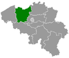
 Zottegem Location in Belgium
Location of Zottegem in East Flanders 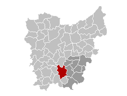 | |||
| Coordinates: 50°52′N 03°48′E / 50.867°N 3.800°ECoordinates: 50°52′N 03°48′E / 50.867°N 3.800°E | |||
| Country | Belgium | ||
| Community | Flemish Community | ||
| Region | Flemish Region | ||
| Province | East Flanders | ||
| Arrondissement | Aalst | ||
| Government | |||
| • Mayor | Jenne De Potter (CD&V) | ||
| • Governing party/ies | CD&V, sp.a | ||
| Area | |||
| • Total | 56.66 km2 (21.88 sq mi) | ||
| Population (1 January 2017)[1] | |||
| • Total | 26,137 | ||
| • Density | 460/km2 (1,200/sq mi) | ||
| Postal codes | 9620 | ||
| Area codes | 09 | ||
| Website | www.zottegem.be | ||


Zottegem (Dutch pronunciation: [ˈzɔtəɣɛm], Sotteghem and Sottegem in older English and French language sources) is a municipality located in Belgium and more particularly in Flanders, in the province of East Flanders. The municipality comprises the town of Zottegem proper and the villages of Elene, Erwetegem, Godveerdegem, Grotenberge, Leeuwergem, Oombergen, Sint-Goriks-Oudenhove, Sint-Maria-Oudenhove, Strijpen and Velzeke-Ruddershove. On January 1, 2006, Zottegem had a total population of 24,548. The total area is 56.66 km² which gives a population density of 433 inhabitants per km².
Zottegem is crossed by two brooks, the Molenbeek in Grotenberge and Leeuwergem, as well as the Molenbeek-Ter Erpenbeek in Godveerdegem, Erwetegem, and Grotenberge.
Zottegem is part of the hilly geographical area Vlaamse Ardennen (Flemish Ardennes). The city is known for its ties with Lamoral, Count of Egmont; Lamoral has a castle, two statues and a museum in Zottegem and is buried in a crypt under the church.
Places of interest
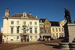
Town Hall and Church of the Assumption of Our Lady 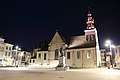
Church of the Assumption of Our Lady 
The former Deanery 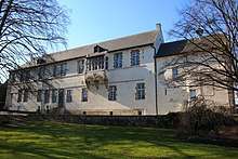
Castle of Lamoral, Count of Egmont 
Museum of Lamoral, Count of Egmont in the town hall 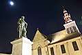
Statue of Lamoral, Count of Egmont 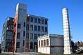
former textile factory 'Sanitary Underwear Company', nowadays the city's administration centre 
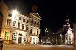
Town Hall 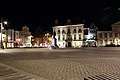
Town Hall,Statue of Lamoral, Count of Egmont 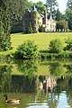
Breivelde Castle 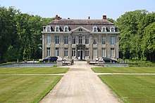
Leeuwergem Castle 
Art Nouveau building 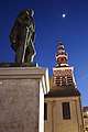
Statue of Lamoral, Count of Egmont 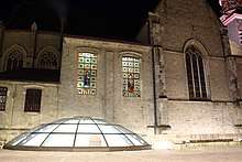
crypt of Lamoral, Count of Egmont 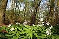
Kloosterbos nature reserve 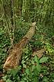
Steenbergse bossen nature reserve
Famous inhabitants
- Lamoral, Count of Egmont, general and statesman, is buried in Zottegem
- Patricia de Martelaere (b. in Zottegem), writer
- Laurent Merchiers, politician
- Lyne Renée (b. in Zottegem), actress
- Jessy De Smet, singer
- Paul Van Cauwenberge, former rector of Ghent University
- Anne De Paepe, former rector of Ghent University
- Bart De Clercq, cyclist
- Magali Uytterhaegen (b. in Zottegem), actress (The curiosity of Chance)
- Urbain Braems, football player and manager, lives in Zottegem
- Tim Matthys, football player, lives in Zottegem
References
- ↑ Population per municipality as of 1 January 2017 (XLS; 397 KB)
External links

- Official website - Information available in Dutch and limited information available in English, French and German
Places adjacent to Zottegem | ||||||||||
|---|---|---|---|---|---|---|---|---|---|---|
| ||||||||||
| Authority control |
|---|