Zomergem
| Zomergem | |||
|---|---|---|---|
| Municipality | |||
 Zomergem: Market Place and St Martin's church | |||
| |||
 Zomergem Location in Belgium
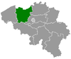
Location of Zomergem in East Flanders  | |||
| Coordinates: 51°07′N 03°33′E / 51.117°N 3.550°ECoordinates: 51°07′N 03°33′E / 51.117°N 3.550°E | |||
| Country | Belgium | ||
| Community | Flemish Community | ||
| Region | Flemish Region | ||
| Province | East Flanders | ||
| Arrondissement | Ghent | ||
| Government | |||
| • Mayor | Tony Vermeire | ||
| • Governing party/ies | CD&V, Open VLD | ||
| Area | |||
| • Total | 38.78 km2 (14.97 sq mi) | ||
| Population (1 January 2017)[1] | |||
| • Total | 8,426 | ||
| • Density | 220/km2 (560/sq mi) | ||
| Postal codes | 9930-9932 | ||
| Area codes | 09 | ||
| Website | www.zomergem.be | ||


Zomergem (Dutch pronunciation: [ˈzoːmərɣɛm]) is a municipality located in the Flanders and in the province of East Flanders, in Belgium. The municipality comprises the towns of Oostwinkel, Ronsele and Zomergem proper. On January 1, 2006, Zomergem had a total population of 8,011. The total area is 38.78 km² which gives a population density of 207 inhabitants per km².
Effective 1 January 2019, Waarschoot, Lovendegem and Zomergem will be merged into the new municipality of Lievegem.
Gallery
 Zomergem, St Martin's church
 Zomergem, townhall
.jpg) Motjes bridge on the Schipdonk canal
Motjes bridge on the Schipdonk canal
References
- ↑ Population per municipality as of 1 January 2017 (XLS; 397 KB)
External links

- Official website (in Dutch)
Places adjacent to Zomergem | ||||||||||
|---|---|---|---|---|---|---|---|---|---|---|
| ||||||||||
This article is issued from
Wikipedia.
The text is licensed under Creative Commons - Attribution - Sharealike.
Additional terms may apply for the media files.