Uedem
| Uedem | ||
|---|---|---|
| ||
 Uedem Location of Uedem within Kleve district 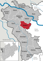  | ||
| Coordinates: 51°40′3″N 6°16′30″E / 51.66750°N 6.27500°ECoordinates: 51°40′3″N 6°16′30″E / 51.66750°N 6.27500°E | ||
| Country | Germany | |
| State | North Rhine-Westphalia | |
| Admin. region | Düsseldorf | |
| District | Kleve | |
| Government | ||
| • Mayor | Rainer Weber | |
| Area | ||
| • Total | 60.94 km2 (23.53 sq mi) | |
| Elevation | 21 m (69 ft) | |
| Population (2016-12-31)[1] | ||
| • Total | 8,229 | |
| • Density | 140/km2 (350/sq mi) | |
| Time zone | CET/CEST (UTC+1/+2) | |
| Postal codes | 47589 | |
| Dialling codes | 0 28 25 | |
| Vehicle registration | KLE | |
| Website | www.uedem.de | |

Uedem is a municipality in the district of Cleves, in North Rhine-Westphalia, Germany. It is located near the border to the Netherlands.
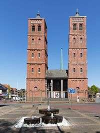
Uedem Catholic church: Pfarrkirche Sankt Laurentius
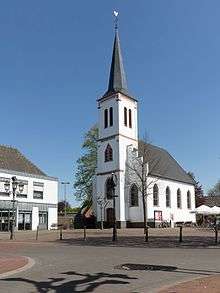
Uedem Reformed Church
Division of the town
Uedem consists of 4 districts
- Uedem
- Uedemerfeld
- Keppeln
- Uedemerbruch
- Brunzenhausen
History
- 5th century Frankish nobleman Odo/Udo started settlement in the area
- 866 first official mentioning as "odeheimero marca"
- 1359 gained town privileges
- 1359 liberation out of the dependency towards Xanten – "Treaty Of Xanten"
- 1794–1814 French occupation
- 1798 loss of town privileges
- World War II heavily destroyed (85%) in several air raids as well as ground operation
Towns and municipalities in Kleve (district) | ||
|---|---|---|
References
- ↑ "Amtliche Bevölkerungszahlen" (in German). Landesbetrieb Information und Technik NRW. Retrieved 2018-02-24.
This article is issued from
Wikipedia.
The text is licensed under Creative Commons - Attribution - Sharealike.
Additional terms may apply for the media files.