Udell Township, Appanoose County, Iowa
| Udell Township, Appanoose County | |
|---|---|
| Township | |
 | |
| Coordinates: 40°48′21″N 092°41′25″W / 40.80583°N 92.69028°WCoordinates: 40°48′21″N 092°41′25″W / 40.80583°N 92.69028°W | |
| Country |
|
| State |
|
| County | Appanoose |
| Area | |
| • Total | 27.27 sq mi (70.62 km2) |
| • Land | 26.83 sq mi (69.50 km2) |
| • Water | 0.43 sq mi (1.12 km2) |
| Elevation[1] | 965 ft (294 m) |
| Population (2010) | |
| • Total | 343 |
| • Density | 13/sq mi (4.9/km2) |
| FIPS code | 19-94155[2] |
| GNIS feature ID | 0468803 |
Udell Township is one of eighteen townships in Appanoose County, Iowa, United States. As of the 2010 census, its population was 343.[3]
It was named for Dr. Nathan Udell, a pioneer settler.[4]
Geography
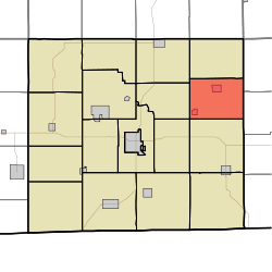
Udell Township covers an area of 27.3 square miles (70.6 km2) and contains two incorporated settlements: Udell and Unionville. According to the USGS, it contains five cemeteries: Clancy, Eaton, Fairview, Taylor and Unionville.
References
- ↑ "US Board on Geographic Names". United States Geological Survey. 2007-10-25. Retrieved 2008-01-31.
- ↑ "American FactFinder". United States Census Bureau. Retrieved 2008-01-31.
- ↑ "Geographic Identifiers: 2010 Demographic Profile Data (G001): Udell township, Appanoose County, Iowa". U.S. Census Bureau, American Factfinder. Retrieved May 9, 2013.
- ↑ L. L. Taylor (1913). Past and Present of Appanoose County, Iowa: A Record of Settlement, Organization, Progress and Achievement. S. J. Clarke Publishing Company. p. 291.
External links
Municipalities and communities of Appanoose County, Iowa, United States | ||
|---|---|---|
| Cities | ||
| Townships | ||
| Unincorporated communities | ||
This article is issued from
Wikipedia.
The text is licensed under Creative Commons - Attribution - Sharealike.
Additional terms may apply for the media files.