Independence Township, Appanoose County, Iowa
| Independence Township, Appanoose County | |
|---|---|
| Township | |
 | |
| Coordinates: 40°51′36″N 093°02′34″W / 40.86000°N 93.04278°WCoordinates: 40°51′36″N 093°02′34″W / 40.86000°N 93.04278°W | |
| Country |
|
| State |
|
| County | Appanoose |
| Area | |
| • Total | 35.73 sq mi (92.54 km2) |
| • Land | 28.10 sq mi (72.77 km2) |
| • Water | 7.64 sq mi (19.78 km2) |
| Elevation[1] | 981 ft (299 m) |
| Population (2010) | |
| • Total | 248 |
| • Density | 9/sq mi (3.4/km2) |
| FIPS code | 19-92016[2] |
| GNIS feature ID | 0468064 |
Independence Township is one of eighteen townships in Appanoose County, Iowa, United States. As of the 2010 census, its population was 248.[3]
History
Independence Township was founded in 1848.[4]
In 1857 William Chadwick, Appanoose County justice of peace, plotted the village of Milledgeville along the east bank of the Chariton River.
North Bend Church and the Chariton River Church are in Independence Township.
Geography
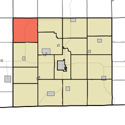
Independence Township covers an area of 35.73 square miles (92.54 km2) and contains no incorporated settlements. According to the USGS, it contains six cemeteries: Brushy, Charitan River, Cozad, Johnson, Milledgeville and Wadlington.
References
- ↑ "US Board on Geographic Names". United States Geological Survey. 2007-10-25. Retrieved 2008-01-31.
- ↑ "American FactFinder". United States Census Bureau. Archived from the original on September 11, 2013. Retrieved 2008-01-31.
- ↑ "Geographic Identifiers: 2010 Demographic Profile Data (G001): Independence township, Appanoose County, Iowa". U.S. Census Bureau, American Factfinder. Retrieved May 9, 2013.
- ↑ The History of Appanoose County, Iowa: Containing a History of the County, Its Cities, Towns, &c. Western Historical Company. 1878. p. 351.
External links
Municipalities and communities of Appanoose County, Iowa, United States | ||
|---|---|---|
| Cities | ||
| Townships | ||
| Unincorporated communities | ||
This article is issued from
Wikipedia.
The text is licensed under Creative Commons - Attribution - Sharealike.
Additional terms may apply for the media files.