Transport in Chad
Transport infrastructure within Chad is generally poor, especially in the north and east of the country. River transport is limited to the south-west corner. As of 2011 Chad had no railways though two lines are planned - from the capital to the Sudanese and Cameroonian borders.during the wet season, especially in the southern half of the country. In the north, roads are merely tracks across the desert and land mines continue to present a danger. Draft animals (horses, donkeys and camels) remain important in much of the country.
Fuel supplies can be erratic, even in the south-west of the country, and are expensive. Elsewhere they are practically non-existent.
Railways
As of 2011 Chad had no railways. Two lines are planned to Sudan and Cameroon from the capital, with construction expected to start in 2012.[1]
Highways
Chad has a total of 33,400 km of roads of which approximately 500 km are paved. Some, but not all of the roads in the capital N'Djamena are paved. Outside of N'Djamena there is one paved road which runs from Massakory in the north, through N'Djamena and then south, through the cities of Guélengdeng, Bongor, Kélo and Moundou, with a short spur leading in the direction of Kousseri, Cameroon, near N'Djamena. Expansion of the road towards Cameroon through Pala and Léré is reportedly in the preparatory stages.
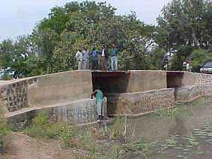
Waterways
Most rivers flow but intermittently. On the Chari, between N’Djamena and Lake Chad, transportation is possible all year round. In September and October, the Logone is navigable between N’Djamena and Moundou, and the Chari between N’Djamena and Sarh. Total waterways cover 4,800 km (3,000 mi), of which 2,000 km (1,250 mi) are navigable all year.
Chari and Logone Rivers are navigable only in wet season (2002). Both flow northwards, from the south of Chad, into Lake Chad.
Pipelines
Since 2003, a 1,070 km pipeline has been used to export crude oil from the oil fields around Doba to offshore oil-loading facilities on Cameroon's Atlantic coast at Kribi.[2]
Seaports and harbors
None (landlocked).
Chad's main routes to the sea are:
- From N'Djamena and the south west of Chad:
- By road to Ngaoundéré, in Cameroon, and then by rail to Douala
- By road to Maiduguri, in Nigeria, and then by rail to Port Harcourt
- From the north and east of Chad:
In colonial times, the main access was by road to Bangui, in the Central African Republic, then by river boat to Brazzaville, and onwards by rail from Brazzaville to Pointe Noire, on Congo's Atlantic coast. This route is now little used.
There is also a route across Sudan, to the Red Sea, but very little trade goes this way.
Links with Niger, north of Lake Chad, are practically nonexistent; it is easier to reach Niger via Cameroon and Nigeria.[3]
Airports
As of 2012 Chad had an estimated 58 airports, only 9 of which had paved runways.[4] Air Tchad (60 percent state owned) provides internal service to 12 locations but suffers from lack of fuel and equipment. The international airport at N’Djamena was damaged in fighting in 1981, but is now served by several international carriers including Air Afrique, which is partly owned by Chad. Another major airport, developed as a military staging area, is located at Sarh. In 2003, scheduled airlines in Chad carried about 46,000 passengers on domestic and international flights.
Airports with paved runways
Statistics on airports with paved runways as of 2012:[4]
| Runway length | Airports |
|---|---|
| over 3,047 metres (10,000 ft) | 2 |
| 2,438 to 3,047 metres (8,000 to 10,000 ft) | 4 |
| 1,524 to 2,437 metres (5,000 to 8,000 ft) | 2 |
| 914 to 1,524 metres (3,000 to 5,000 ft) | 0 |
| under 914 metres (3,000 ft) | 1 |
| TOTAL | 9 |
List of airports with paved runways:[5]
Airports - with unpaved runways
Statistics on airports with unpaved runways as of 2012:[4]
| Runway length | Airports |
|---|---|
| 2,438 to 3,047 metres (8,000 to 10,000 ft) | 2 |
| 1,524 to 2,437 metres (5,000 to 8,000 ft) | 16 |
| 914 to 1,524 metres (3,000 to 5,000 ft) | 20 |
| under 914 metres (3,000 ft) | 11 |
| TOTAL | 49 |
Airline
SAGA Airline of Chad - see http://www.airsaga.com
Ministry of Transport
The Ministry is represented at the regional level by the Regional Delegations, which have jurisdiction over a part of the National Territory as defined by Decree No. 003 / PCE / CTPT / 91. Their organization and responsibilities are defined by Order No. 006 / MTPT / SE / DG / 92.
The Regional Delegations are:
The Regional Delegation of the Center covering the regions of Batha, Guéra and Salamat with headquarters in Mongo;
The Regional Delegation of the Center-Ouest covering the regions of Chari Baguirmi and Hatier Lamis with headquarters Massakory;
The North-West Regional Delegation covering the Kanem and Lake regions with headquarters in Mao;
The Western Regional Delegation covering the areas of Mayo-East Kebbi, Mayo-West Kebbi and Tandjile with headquarters in Bongor;
The Eastern Regional Delegation covering the regions of Wadi Fira and Ouaddai with headquarters in Abéché;
The South-East Regional Delegation covering the Mandoul and Moyen Chari regions with headquarters in Sarh;
The Southwest Regional Delegation covering the regions of Logone Occidental and Logone Orientai with headquarters in Moundou;
The Northern Regional Delegation covering the BET region with headquarters in Faya.
Each Regional Delegation is organized into regional services, namely: the Regional Roads Service, the Regional Transport Service, the Civilian Buildings Regional Service and, as needed, other regional services may be established in one or more Delegations .[6]
See also
References
- ↑ "Work to begin on Chad rail network". www.railwaygazette.com. Railway Gazette International. 13 January 2012.
- ↑ "Chad-Cameroon Pipeline: Project Overview". The World Bank Group. Archived from the original on 26 March 2006.
- ↑ USA, Internatioin Business Pubns (2008-02-15). Global Logistics Assessments Reports Handbook: Strategic Transportation and Customs Information for Selected Countries. Int'l Business Publications. ISBN 9780739766033.
- 1 2 3 "Chad:Transport". The World Factbook. CIA. 15 August 2012.
- ↑ "Airports in Chad". www.aircraft-charter-world.com. Air Broker Center International AB. 2009.
- ↑ "Ministry of Transportation Chad Projects". infrastructures-tchad.org. Retrieved 2018-05-26.
External links
- "Réseaux des transports en République du Tchad (Transport networks in the Republic of Chad)" (PDF). www.comcec.org (in French). Ministère des Infrastructures et Equipements, Republique du Tchad (Ministry of Infrastructure and Equipment, Republic of Chad). September 2011. Archived from the original (PDF) on 12 May 2013. Retrieved 13 January 2012.
- Maps
![]()

Currency: Central African CFA franc | |
| Communications |
|
| Industries: | |