Torfaen
| Torfaen County Borough Bwrdeistref Sirol Torfaen | ||
|---|---|---|
| county borough | ||
| ||
 Map of Torfaen with principal towns and location in Wales in inset | ||
| Admin HQ | Pontypool | |
| Largest town | Cwmbran | |
| Government | ||
| • Type | Torfaen County Borough Council | |
| • Control | Labour | |
| • MP | ||
| • AM | ||
| Area | ||
| • Total | 126 km2 (49 sq mi) | |
| Area rank | Ranked 20th | |
| Population (2017) | ||
| • Total | 92,300 | |
| • Rank | Ranked 18th | |
| • Density | 734/km2 (1,900/sq mi) | |
| • Density rank | Ranked 3rd | |
| • Ethnicity |
98% White 1.1% Asian 0.7% Mixed 0.2% Black | |
| Welsh language | ||
| • Rank | Ranked 19th | |
| • Any skills | 14.5% | |
| Geocode |
00PM (ONS) W06000020 (GSS) | |
| ISO 3166 code | GB-TOF | |

Torfaen (/tɔːrˈvaɪn/; Welsh: Tor-faen [tɔrˈvaɪn]) is a county borough in Wales within the historic boundaries of Monmouthshire. It was originally formed in 1974 as a district of the county of Gwent and in 1996 it was reconstituted as a principal area.
Name
Torfaen (meaning "break-stone") is an old name for the river – today called Afon Lwyd ("grey river") – which flows through the county borough from its source north of Blaenavon southward through Abersychan, Pontypool, and Cwmbran.
Location
Torfaen is bordered by the county of Monmouthshire to the east, the city of Newport to the south, and the county boroughs of Caerphilly and Blaenau Gwent to, respectively, the south-west and north-west.
Area characteristics
The area has a population of around 91,000. Much of the southern part of the county borough around the Cwmbran new town conurbation is now urbanised. The north of the county borough is greener and retains extensive areas of countryside, especially on the route to Blaenavon.
The administrative centre is Pontypool in the centre of the county borough. Most of the administration of Torfaen County Borough Council is conducted from the Civic Centre here.
Local landmarks
The highest point of the county is Coity Mountain.
Pontypool Park
- Pontypool Park is the name given to the former principal residence of Pontypool (now a secondary school) and the 160-acre (0.65 km2) park that surrounds it. The park contains Pontypool Leisure Centre and sports facilities and is the home of Pontypool RFC. The park includes a folly, shell grotto and ornamental ponds. Much of the area is given to woodland but there is extensive open grassland. The American Gardens were opened to the public in 2008, after being closed to visitors for many years, and a restoration project is under way. Torfaen County Borough Council is currently mapping all the trees from the park to remove and then replant those dying and diseased.[1]
Cwmbran Centre
- Cwmbran Centre is advertised as the second largest under-cover shopping centre in Wales. The centre includes many familiar high-street stores.
- The former mining town of Blaenavon in the northern part of the county borough is now a recognised UNESCO World Heritage Site.
Politics
Torfaen is historically a safe Labour Party seat. At present the MP is Nick Thomas-Symonds. Constituents in Croesyceiliog North, Croesyceiliog South, Llanyrafon North and Llanyrafon South wards are served by the Monmouth MP, Conservative David Davies. Torfaen is also a Welsh Assembly constituency, presided over by Labour AM, Lynne Neagle.
Torfaen Council has historically been a Labour-controlled authority, however the 2008 Local Elections saw Labour fail to win enough seats to hold a majority, resulting in a coalition with Plaid Cymru and Independent Councillors.
In the 2012 Local Elections, Labour regained majority control of Torfaen County Borough Council, winning 30 out of a possible 44 seats.
Education
Secondary schools in the area are:
- St Albans RC High School, Pontypool
- West Monmouth School, Pontypool
- Croesyceiliog School, Cwmbran
- Ysgol Gyfun Gwynllyw, Pontypool (Welsh-language)
- Abersychan Comprehensive School, Pontypool
- Fairwater High School, Cwmbran
- Llantarnam School, Cwmbran
Further education, vocational training and some higher education is provided at the Ponytpool Campus of Coleg Gwent, formerly Pontypool College.
In 2012 Torfaen County Borough Council was criticised for keeping 2,400 laptop computers, originally intended to be used by secondary school pupils and teachers, unused for at least a year "because it couldn't figure out what to do" with the equipment, which originally cost over a million pounds.[2]
Railways
Traversed by the Welsh Marches Line with stations at Pontypool & New Inn and Cwmbran run by Arriva Trains Wales. There is also the Pontypool and Blaenavon Railway in Blaenavon.
See also
References
- ↑ "Torfaen man's bid to make map of trees". South Wales Argus. 18 December 2008. Retrieved 19 April 2009.
- ↑ Parnell, Brid-Aine (5 November 2012), "Welsh council's unused mountain of 2,400 laptops", The Register, retrieved 7 December 2012
External links
- Torfaen at Curlie (based on DMOZ)
- Torfaen County Borough Council
- American Gardens, Pontypool Park
- Cwmbran, A Short History
- Blaenavon, World Heritage Site
- Torfaen constituency breakdown, 2001
- Council and Democracy in Torfaen
| Principal settlements | 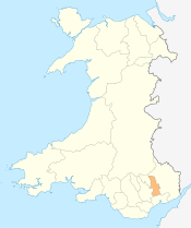 | |
|---|---|---|
| Electoral wards | ||
| Communities | ||
| Places of interest | ||
| Rivers and canals | ||
| Topics | ||
Transport in Torfaen | ||
|---|---|---|
| Road |  | |
| Bus | ||
| Railway lines | ||
| Railway stations | ||
| Heritage railways | ||
| Cycling | ||
| Walking | ||
| Waterways | ||