Tittybong, Victoria
| Tittybong Victoria | |||||||||||||||
|---|---|---|---|---|---|---|---|---|---|---|---|---|---|---|---|
 Tittybong | |||||||||||||||
| Coordinates | 35°44′0″S 143°22′0″E / 35.73333°S 143.36667°ECoordinates: 35°44′0″S 143°22′0″E / 35.73333°S 143.36667°E | ||||||||||||||
| Population | 3 (2016 census)[1] | ||||||||||||||
| Postcode(s) | 3542 | ||||||||||||||
| LGA(s) | |||||||||||||||
| State electorate(s) | Murray Plains | ||||||||||||||
| Federal Division(s) | Mallee | ||||||||||||||
| |||||||||||||||
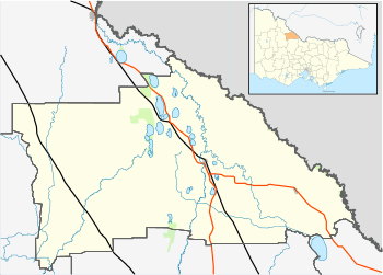
Tittybong is a locality in the northwest of Victoria, Australia, within the Shires of Gannawarra and Buloke. Tittybong is located west of Kerang and east of the Calder Highway. It is south of Swan Hill, Tittybong's nearest large town.
History
The Tittybong Post Office opened on 1 January 1884 by Arthur and Marco and closed in 1968.[2]
References
- ↑ Australian Bureau of Statistics (27 June 2017). "Tittybong (State Suburb)". 2016 Census QuickStats. Retrieved 18 March 2018.

- ↑ Premier Postal History, Post Office List, archived from the original on 2008-05-10, retrieved 2008-04-11
This article is issued from
Wikipedia.
The text is licensed under Creative Commons - Attribution - Sharealike.
Additional terms may apply for the media files.