Tin Hau temples in Hong Kong

The following is an incomplete list of the over 100 Tin Hau Temples dedicated (at least partially) to Tin Hau (Mazu) in Hong Kong. They include:
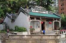
- Tin Hau temple, located at 10 Tin Hau Temple Road, Causeway Bay, east of Victoria Park, in Eastern District, on Hong Kong Island. It is a declared monument.[1] The temple has given its name to the MTR station serving it (Island Line), and subsequently to the neighboring area of Tin Hau.
- The Tin Hau temple in Yau Ma Tei is also famous in Hong Kong. The public square, Yung Shue Tau before it is surrounded by the popular Temple Street night market.
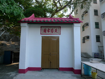
- The Tin Hau Temple at Joss House Bay is considered the most sacred. Built in 1266, it is the oldest and the largest Tin Hau Temple in Hong Kong.[2] It is a Grade I historic building.
Festivals
Two temples have a marine parade to celebrate the Tin Hau Festival (天后誕; Tiānhòudàn): Tin Hau Temple on Leung Shuen Wan (High Island)[3] and Tin Hau Temple on Tap Mun, which has it once every ten years.[4]
The celebration at Tin Hau Temple, Joss House Bay is attended annually by upwards of 40,000 to 50,000 people. Another large celebration takes place at the Tai Shu Ha temple in Yuen Long District.[5]
List by district
Note 1: Unless otherwise noted, typically in italics, Tin Hau is the main deity of the temples listed below.
Note 2: A territory-wide grade reassessment of historic buildings is ongoing. The grades listed in the table are based on this update (10 September 2013). The temples with a "Not listed" status in the table below are not graded and do not appear in the list of historic buildings considered for grading.
Note 3: While most probably incomplete, this list is tentatively exhaustive.
Eastern District
| Location | Notes | Status | References | Photographs |
|---|---|---|---|---|
| No. 53, Shau Kei Wan Main Street East, Shau Kei Wan |
Shau Kei Wan Tin Hau Temple (筲箕灣天后廟). The original temple, built in 1845,[6] was destroyed by a typhoon in 1872. A new temple was erected in-situ in 1873.[7] Originally situated on a slope with its front part facing the sea. Renovated in 1876, 1902, 1920, 1948 and 2005. Managed by the Chinese Temples Committee.[8] The interior of the temple can be explored with Google Street View. | Grade II | .doc |  |
| A Kung Ngam Village Lane, A Kung Ngam, Shau Kei Wan |
Yuk Wong Temple. Yuk Wong Kung Din (玉皇宮殿) or Yuk Wong Bo Din (玉皇寶殿). Dedicated to the Jade Emperor. Partly dedicated to Tin Hau: altar on the left side of the main altar. Managed by the Chinese Temples Committee. The interior of the temple can be explored with Google Street View. |
Not listed |  | |
| On the main breakwater of Shaukeiwan Typhoon Shelter. It is only accessible by boat |
Tin Hau Temple and Kwun Yum Temple (望海觀音古廟) | Not listed |  | |
| Formerly on a small island within the former Aldrich Bay Typhoon Shelter, Shau Kei Wan 22°16′53″N 114°13′48″E / 22.281277°N 114.229913°E |
Hoi Shum Temple (海心廟; "temple in the middle of the sea"). Built in 1845 for the worship of Tin Hau. It was demolished in the 1980s when the Typhoon shelter was reclaimed. Some of the temple pillars and footing stones are now preserved in the Shau Kei Wan Shing Wong Temple. | Not listed Demolished |
_01.jpg) | |
| Fei Tsui Road, Chai Wan |
Chai Wan Tin Hau Temple (柴灣天后廟) | Not listed |  | |
| Lok Kang Po, Siu Sai Wan, Chai Wan 22°15′50″N 114°14′44″E / 22.263924°N 114.245608°E |
Lok Kang Po Tin Hau Temple (樂耕埔天后廟). At the current location since 1967.[9] |
Not listed |  | |
Islands District
| Location | Notes | Status | References | Photographs |
|---|---|---|---|---|
| Near Pak She San Tsuen, Cheung Chau Wan, Cheung Chau |
Pak She Tin Hau Temple (長洲北社天后廟). Located 100m northwest of the Pak Tai Temple.[10] Situated within the boundary of the Chung Shak Hei Home for the Aged. The temple was probably built around 1767.[7] |
Grade II |  | |
| Chung Hing Street (Tai Shek Hau), Cheung Chau |
Tai Shek Hau Tin Hau Temple (大石口天后廟).[10] Built some time before the 4th year of the Tongzhi reign (1865) of the Qing Dynasty.[7] |
Grade II |  | |
| Sai Wan, Cheung Chau |
Sai Wan Tin Hau Temple (西灣天后廟). Located west of Sai Wan (Western Bay), on the southwestern tip of the island.[10] Built some time before 1929.[7] |
Grade III |  | |
| North of Morning Beach aka. Nam Tam Wan (南氹灣),[10] Cheung Chau |
Nam Tam Wan Tin Hau Temple (南氹灣天后廟). | Not listed | 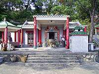 | |
| Pak She Street, Tung Wan, Cheung Chau |
Yuk Hui Temple aka. Pak Tai Temple. Partly dedicated to Tin Hau: altar on the right side of the main altar. Managed by the Chinese Temples Committee. The interior of the temple can be explored with Google Street View. |
Grade I | 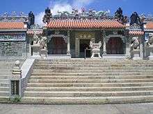 | |
| Fan Lau Miu Wan, Fan Lau, Lantau Island |
Built during the early Qing Dynasty. Rebuilt in 1820.[11] Repaired in 1820, 1928, 1976.[12] | Grade III |  | |
| Yi O (二澳), Lantau Island Unconfirmed location. |
Listed with the note "no information" in "Distribution of temples on Lantau Island as recorded in 1979", in Journal of the Royal Asiatic Society Hong Kong Branch.[12] | Not listed | ||
| San Tsuen, Tai O |
Yim Tin Tin Hau Temple (鹽田天后古廟). Built in 1644,[13] in the early Qing Period, repaired in 1838, 1892, 1895, 1946 and 1972.[12] |
Not listed |  | |
| Kat Hing Back Street, Tai O |
Adjacent to Kwan Ti temple (right side). Built in 1772.[14] | Grade III |  | |
| Sha Lo Wan, Lantau Island |
Built in 1919. Located on the left of the Ba Kong Temple, which is dedicated to Hung Shing. A wall is connecting the two temples at the front façade.[15] (Viewed from the front, the Tin Hau Temple is on the right) | Nil grade | 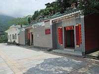 | |
| Chek Lap Kok New Village, Wong Lung Hang Road, Tung Chung, Lantau Island |
Built in 1823 at the north east of Chek Lap Kok. The entire temple was built of granite quarried on the island.[16] Repaired in 1978.[12] Dismantled in 1991 because of the construction of the new airport, and rebuilt in 1994 at its present location.[7][17] | Grade II |  | |
| Tai Pak (大白), Lantau Island Unknown location, possibly at Discovery Bay |
Listed with the note "no information" in "Distribution of temples on Lantau Island as recorded in 1979", in Journal of the Royal Asiatic Society Hong Kong Branch.[12] | Not listed | ||
| Nim Shue Wan, Lantau Island |
Tin Hau Temple, Peng Chau (坪洲天后宮). Built in 1920.[7] The statue of Tin Hau was moved to Peng Chau by the villagers during the Japanese Occupation.[12][18] | Nil grade | picpic | |
| Luk Tei Tong, Mui Wo, Lantau Island |
Not listed |  | ||
| Shap Long Chung Hau (十塱涌口), Chi Ma Wan, Lantau Island |
It was rebuilt in 1951.[12] | Not listed | pic | |
| Chi Ma Wan Road (along Lantau Trail Stage 12), Ham Tin Kau Tsuen, Ham Tin, Pui O, Lantau Island |
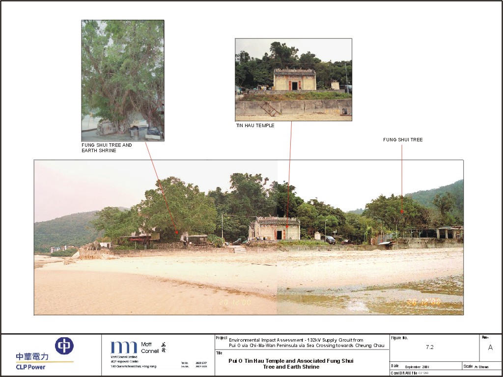
Built in the Ming Dynasty, rebuilt in 1798 and repaired in 1947,[12] 1974 and 1995.[19] | Not listed |  | |
| Tong Fuk, Lantau Island 22°13′41″N 113°55′59″E / 22.228016°N 113.933013°E |
Not listed |  | ||
| No. 1A Yung Shue Wan Main Street, Yung Shue Wan, Lamma Island |
Built some time before the 2nd year of Guangxu reign (1876) of the Qing Dynasty.[20] An uncommon feature of the temple is that it is guarded by two Western lions. They replaced the original Chinese lions which had been damaged in the 1960s.[21] | Grade III |  | |
| O Tsai, Yung Shue Wan, Lamma Island |
Not listed |  | ||
| Sok Kwu Wan, Lamma Island |
Tin Hau Temple, Sok Kwu Wan (索罟灣天后宮). Probably built between 1826 and 1868.[7] | Nil grade | 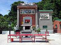 | |
| Luk Chau Village, Lamma Island |
Believed to be built in the late Qing Dynasty (1644-1911).[7] | Nil grade | 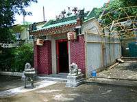 | |
| Nos. 69A & 69B, Wing On Street, Peng Chau |
Probably built in 1792.[7] Managed by the Chinese Temples Committee. The interior of the temple can be explored with Google Street View. |
Grade II |  | |
| Po Toi Island |
Tin Hau Temple, Po Toi Island (蒲台島天后廟). Renovated in 1893.[22] | Nil grade | 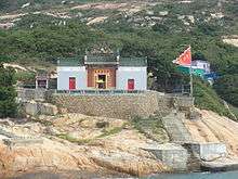 | |
| Tai A Chau, Soko Islands |
Built in 1828.[23] The Tong Fuk village committee contributed to its renovation in 2000.[24] | Not listed | ||
| Siu A Chau, Soko Islands |
Not listed | pic | ||
| Hei Ling Chau 1) Former 2) Current temple: |
There are two Tin Hau temples on the island. One was built in 1925 and was converted into a store room. The current temple was built in 1985.[25] | Not listed | Former | |
| Shek Kwu Chau |
Not listed | |||
Kowloon City District
| Location | Notes | Status | References | Photographs |
|---|---|---|---|---|
| No. 49 Ha Heung Road, To Kwa Wan |
Tin Hau Temple, To Kwa Wan (土瓜灣天后廟). Built in 1885. The temple also houses the statue of Lung Mo, which was transferred here in 1964, when the temple at Hoi Sham Island was demolished following land reclamation.[26][27] Managed by the Chinese Temples Committee. The interior of the temple can be explored with Google Street View. |
Grade III |  | |
| 1/F, 40 Pak Tai Street, To Kwa Wan |
Building demolished as of 2016. Wah Kwong Tak Yan Tong (華光得因堂). Located in a residential and commercial building. Partly dedicated to Tin Hau. |
Not listed | Picture: site of the former building. |
 |
Kwai Tsing District
| Location | Notes | Status | References | Photographs |
|---|---|---|---|---|
| Chung Mei Lo Uk Village, Tsing Yi Island[28] |
Tin Hau Temple, Tsing Yi (青衣天后古廟). The Tin Hau Festival in Tsing Yi lasts from 1st to 5th day of the 4th lunar month each year.[29] The temple was originally located near Tsing Yi Tong. Upon reclamation of Tsing Yi, it was moved to Ha Ko Tan (下高灘), near today's Chung Mei Lo Uk Village. | Not listed | 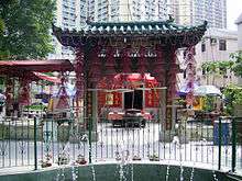 | |
| Near Ha Kwai Chung Tsuen, Kwai Chung. Located across Kwai Chung Road from Kwai Fong Terrace. |
Built prior to 1828, the original temple was relocated to the present site in 1966 to make way for the port reclamation in Kwai Chung.[7][30] | No grade | 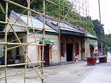 | |
| Opposite to Chui Kwai House, Kwai Chung Estate, Tai Wo Hau |
Tin Hau Temple (天后廟) | Not listed |  | |
| Near Yan Kwai House, Kwai Chung Estate, Tai Wo Hau |
Kwai Chung Fu Tak Temple (葵涌福德堂) Partly dedicated to Tin Hau. |
Not listed | ||
Kwun Tong District
| Location | Notes | Status | References | Photographs |
|---|---|---|---|---|
| Ma Wan Tsuen, Lei Yue Mun (Kowloon) |
Tin Hau Temple, Lei Yue Mun (鯉魚門天后廟). First built in 1753.[7] | Grade III |  | |
| Cha Kwo Ling Road, Cha Kwo Ling |
Tin Hau Temple, Cha Kwo Ling (茶果嶺天后廟). Initially built in Cha Kwo Ling Village during the Qing Dynasty, it was moved to Cha Kwo Ling Road in 1941, and was under maintenance and repair in 1947.[31] Opened officially in 1948. Managed by the Chinese Temples Committee.[7] The interior of the temple can be explored with Google Street View. |
Grade III |  | |
| Rehab Path, off Lei Yue Mun Road. On a hill between Kwun Tong and Lam Tin |
Tin Hau Temple and Sam Shan Kwok Wong Temple, Kwun Tong (三山國王古廟 (觀塘)). | Not listed | _02.jpg) | |
| Po Lam Road, near the junction with Sau Mau Ping Road, Sau Mau Ping. Near Po Tat Estate. |
Hoi Kwok Tin Hau Shing Mo Temple (海國天后聖母廟). The opening ceremony took place on 24 November 2012.[32] | Not listed | .jpg) | |
| Sau Mau Ping Road, Sau Mau Ping. |
Part of a complex built in 1964 without government approval. Demolished in 2008 to make way for the new On Tat Estate. | Not listed | picture picture | |
North District
| Location | Notes | Status | References | Photographs |
|---|---|---|---|---|
| Lung Yeuk Tau, Fanling |
Tin Hau Temple, Lung Yeuk Tau (粉嶺龍躍頭天后宮). Located along the Lung Yeuk Tau Heritage Trail, next to Tang Chung Ling Ancestral Hall. | Declared |  | |
| Sai Ho (西澳), Kat O Island |
Tin Hau Temple, Kat O (吉澳天后宮). Probably built in 1763.[33][34] | Grade III | 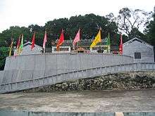 | |
| No. 72 Ping Che, Ta Kwu Ling |
Ping Yuen Tin Hau Temple (坪源天后古廟). Probably built in 1756. The temple is flanked by two buildings: the Ping Yuen Community Hall (right) and the Sing Ping She Memorial Hall (left). | Grade III | 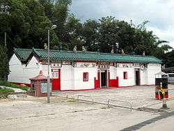 | |
| Ng Uk Tsuen (吳屋村), Ta Kwu Ling |
(to be confirmed) | Not listed | ||
| Muk Wu Tsuen, Ta Kwu Ling |
Tin Hau Temple, Muk Wu (木湖村天后廟). Built around 1912-1913.[35] | Grade III |  | |
| Ma Mei Ha (馬尾下), Ta Kwu Ling 22°31′04″N 114°10′36″E / 22.517916°N 114.176745°E |
Not listed | picture picture |  | |
| Tsung Yuen Ha (松園下), Ta Kwu Ling 22°33′02″N 114°09′20″E / 22.550621°N 114.15554°E |
Not listed | picture picture | ||
| No. 41 Hung Kiu San Tsuen (紅橋新村), Sheung Shui |
Tin Hau Temple (天后古廟). Rebuilt in 1962.[36] | No grade | 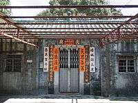 | |
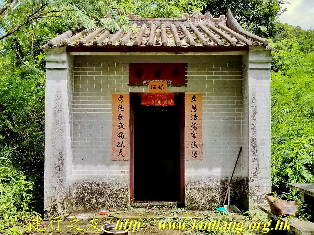
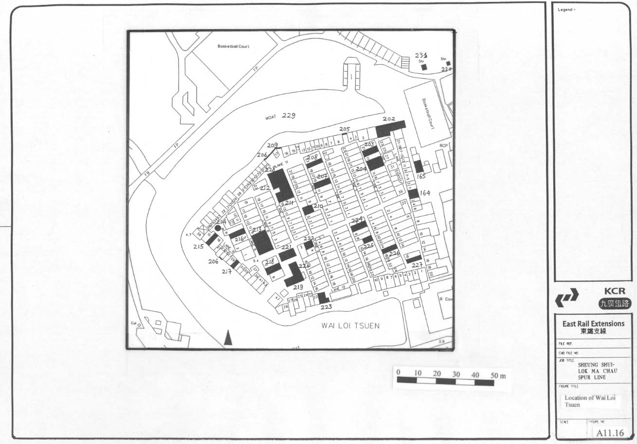
| Wai Loi Tsuen, Sheung Shui Wai, Sheung Shui Item #221 on map: |
Completely renovated to modern structure.[37] | Not listed |  | |
| Ping Kong, Sheung Shui |
Within a walled village.[38] The temple is featured in Jackie Chan's 1983 film Project A.[39] | Not listed |  | |
| Yim Liu Ha, Sha Tau Kok |
Not listed |  | ||
| Wu Shek Kok, Sha Tau Kok |
Not listed |  | ||
| Luk Keng Road, Nam Chung |
Nam Chung Tin Hau Temple (南涌天后宮). The temple complex contains also a Kwun Yam Temple and a Dragon King shrine. | Not listed |  | |
Sai Kung District
| Location | Notes | Status | References | Photographs |
|---|---|---|---|---|
| Joss House Bay (大廟灣; Tai Miu Wan) |
Tin Hau Temple, Joss House Bay Managed by the Chinese Temples Committee. The interior of the temple can be explored with Google Street View. |
Grade I |  | |
| Tin Chau Road, Tin Ha Wan Village (田下灣村), Hang Hau |
Tin Hau Temple, Hang Hau (坑口天后廟). Built around 1840.[40] | Grade III |  | |
| Leung Shuen Wan Chau (High Island), Sai Kung District |
Tin Hau Temple, Leung Shuen Wan (糧船灣天后宮). Probably built in 1741. It is located in the original coastal site and is feng shui-oriented.[7] | Grade III |  | |
| Po Tung Road (普通道), Sai Kung Town |
Tin Hau Temple and Hip Tin Temple (西貢墟天后古廟及協天宮). Built in the 1910s-1920s. | Grade II |  | |
| Wong Keng Tei, Pak Tam Chung, Sai Kung Peninsula |
Not listed |  | ||
| Off Tai Mong Tsai Road, Tai Mong Tsai (大網仔), Sai Kung Peninsula |
Not listed |  | ||
| Pak Kong, Sai Kung Peninsula |
Built before 1872. The temple is located on a feng shui marking the eastern edge of the residential area of the village.[41] | Not listed | 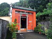 | |
| Nam Wai |
Not listed | 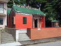 | ||
| South Ninepin Island (Ninepin Group) |
Not listed | picture Note: located at the top of the hill at the centre of the picture => |
 | |
| Nam Tong (南堂), Tung Lung Chau |
A Hung Shing Temple. Partly dedicated to Tin Hau. Built before 1931. Kwun Yam and Tin Hau are housed at the altars of the left and right chambers respectively. A large rock, called Holy Rock (聖石) by the worshippers, is protruding from the rear wall of the right chamber. |
Nil grade |  | |
Sham Shui Po District
| Location | Notes | Status | References | Photographs |
|---|---|---|---|---|
| No.180-184 Yee Kuk Street (醫局街), at the corner of Kweilin Street, Sham Shui Po |
Tin Hau Temple, Sham Shui Po (深水埗天后廟). Erected in 1901.[7] Managed by the Chinese Temples Committee. The interior of the temple can be explored with Google Street View. |
Grade III | .jpg) | |
Southern District
| Location | Notes | Status | References | Photographs |
|---|---|---|---|---|
| No. 182 Aberdeen Main Road, Aberdeen |
Tin Hau Temple, Aberdeen (石排灣天后廟). Built in 1851.[7] Managed by the Chinese Temples Committee. The interior of the temple can be explored with Google Street View. |
Grade III | .jpg) | |
| South of Yuk Fai House (旭暉閣), Yue Fai Court, Aberdeen |
Built around 1955. | Not listed | ||
| Middle Island[6] |
Destroyed by Typhoon Hato on August 23, 2017. | Not listed | ||
| Stanley Plaza, Stanley Main Street, Stanley |
Tin Hau Temple, Stanley (赤柱天后廟). Built in 1767.[7] | No grade | 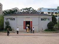 | |
| No. 219 Lan Nai Wan Village, Shek O |
Lin Hok Sin Koon (蓮鶴仙觀). Partly dedicated to Tin Hau. | Not listed | ||
| No. 333 Shek O Village, Shek O |
Tin Hau Temple, Shek O (石澳天后廟). Believed to be built before 1891.[7] | Grade III |  | |
| Hok Tsui (鶴咀) 22°12′30″N 114°15′36″E / 22.208419°N 114.259869°E |
Not listed | picture | ||
Tai Po District
| Location | Notes | Status | References | Photographs |
|---|---|---|---|---|
| No. 39 Ting Kok Road, Tai Po Kau Hui |
Tin Hau Temple, Tai Po Kau Hui (大埔舊墟天后宮). Built before 1691. On the left of the Tin Hau Temple is Hip Tin Temple dedicated to Kwan Tai. On its right is Tam Sin Temple where Tam Sin is revered.[7] | Grade III | 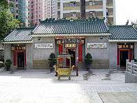 | |
| Nos. 52-53 Tsz Tong Tsuen (祠堂村), Tai Hang, Tai Po |
Tin Hau Temple and Man Tai Temple (天后宮及文帝古廟). The Tin Hau Temple is adjacent to a Man Tai Temple. Built in 1727 and 1884 respectively. | Nil grade |  | |
| Fong Ma Po, Lam Tsuen |
Near the Lam Tsuen Wishing Trees. Believed to be built in 1768 or around 1771.[42] The temple was damaged by Typhoon Dot in 1964 and by a fire in 1965. It was extensively renovated in 1967.[43] | Grade II |  | |
| Shuen Wan area of Plover Cove, next to Kei Shan Kok between Wai Ha and Ha Tei Ha.[44] |
One of the three temples of the Sam Kung Temples complex (三宮廟). The other ones are a Hip Tin Temple, dedicated to Kwan Tai (Guan Yu), and a Temple of Confucius.[44] The Sam Kung Temples complex had been destroyed by a typhoon in 1936 and was reconstructed in 2009.[45] | Not listed |  | |
| Po Sam Pai (布心排) 22°28′16″N 114°12′35″E / 22.471146°N 114.209671°E |
Not listed | picture | ||
| Ha Wai (下圍), Tap Mun Chau |
The temple complex comprises three temples in two buildings: the first building is a Tin Hau Temple, built in 1737, to which an annex was later added, housing a Kwan Tai Temple.[46] On its left, Shui Yuet Kung, built in 1788, is dedicated to Kwun Yam and the Earth God.[47] | Grade II |  | |
| Sha Tau, Ping Chau |
Built in 1765. Two other deities are worshipped at its side altars: Hung Shing and Tai Sui.[48] | Grade III |  | |
| Ko Lau Wan, North Sai Kung Peninsula |
Not listed | 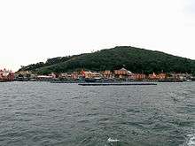 | ||
Tsuen Wan District
| Location | Notes | Status | References | Photographs |
|---|---|---|---|---|
| Wai Tsuen Road, Tsuen Wan Town. Situated at the east of Luk Yeung Sun Chuen, next to Block J. |
Tin Hau Temple, Tsuen Wan (荃灣天后宮). Built in 1721[49] during the reign of Kangxi (1661–1722) of the Qing Dynasty.[7] | Grade II |  | |
| Yau Kam Tau Village, Po Fung Road, Tsuen Wan |
Yau Kam Tau Village was established in 1864. It was resited to the present location in 1984, following the development of the MTR. The temple is a single storey stone house. It lies by the side of the Yau Kam Tau Village Rural Committee, on a terrace built by boulders.[50] | Not listed |  | |
| Nos. 56-58 Castle Peak Road, Tsing Lung Tau |
Built before 1889.[7] | No grade |  | |
| No. 38 Ma Wan Main Street, Ma Wan |
It was renovated in 1860.[7] | Grade III | 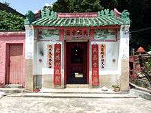 | |
| Northern beach, Ma Wan |
Recently rebuilt. Said to have been originally built by the local pirate Cheung Po Tsai. | Not listed | original |  |
Tuen Mun District
| Location | Notes | Status | References | Photographs |
|---|---|---|---|---|
| Tsing Chuen Wai,[51] Lam Tei |
Not listed | |||
| Fuk Hang Tsuen Path (福亨村徑), Fuk Hang Tsuen (福亨村), Lam Tei |
Fuk Hang Tsuen Tin Hau Temple (泰亨村). The temple was rebuilt in 2015. | Not listed |  | |
| Tin Hau Road, Tuen Mun[51] |
Called the Hau Kok Tin Hau Temple, the temple stands by the Tuen Mun River Channel.[52] Subsequent to reclamation, the temple is now enclosed by factories.[7] | No grade | 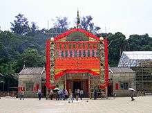 | |
| Castle Peak Road, opposite Sam Shing Estate, Sam Shing Hui, Tuen Mun |
Castle Peak Sam Chau Ma Temple (青山三洲媽廟) | Not listed | 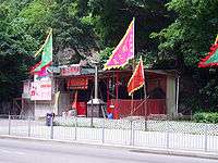 | |
| Along Castle Peak Road, near Hong Kong Gold Coast |
Not listed | |||
| Yu Chui Street, So Kwun Tan |
Not listed |  | ||
| So Kwun Wat Tsuen Road, So Kwun Wat Tsuen |
Not listed |  | ||
| No. 21 So Kwun Wat San Tsuen (掃管笏新村) |
Not listed | |||
| Tai Lam Kok, near Tai Lam Chung, Tuen Mun. Located across Castle Peak Road from the Maritime Services Training Institute. |
Renovated in 1955.[7] | No grade |  | |
| Pak Long, Lung Kwu Tan[51] |
Not listed | 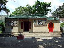 | ||
| Sha Chau |
Probably built in 1846. Rebuilt in 1998.[7] | No grade | ||
Wan Chai District
| Location | Notes | Status | References | Photographs |
|---|---|---|---|---|
| No. 10, Tin Hau Temple Road, Causeway Bay |
Tin Hau Temple, Causeway Bay | Declared |  | |
| No. 9, Blue Pool Road, at the intersection with Ventris Road, Wong Nai Chung (Happy Valley) |
The Tam Kung Temple, together with the Tin Hau Temple at the back, was relocated from the former Wong Nai Chung Village to the present site in 1901 to pave way for the redevelopment of Happy Valley.[53] Managed by the Chinese Temples Committee. The temple complex can be explored with Google Street View. |
No grade | .doc |  |
| Moored at the Causeway Bay Typhoon Shelter |
Floating Tin Hau Temple (水上三角天后廟). It has been docked at its current location since 1955.[54] A new temple on land is planned, following land reclamation. | Not listed |  | |
Wong Tai Sin District
| Location | Notes | Status | References | Photographs |
|---|---|---|---|---|
| Behind Lok Tai House, Lok Fu Estate, Lok Fu |
Tin Hau Temple, Lok Fu (慈德社天后古廟 or 老虎岩(樂富)天后聖母古廟) |
Not listed | 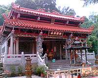 | |
| Nga Tsin Wai Tsuen |
Not listed |  | ||
Yau Tsim Mong District
| Location | Notes | Status | References | Photographs |
|---|---|---|---|---|
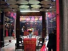
| Temple Street, Yau Ma Tei |
The Tin Hau Temple Complex comprises a row of five adjacent temples: a Tin Hau Temple, a Shing Wong Temple, a Kwun Yum temple, Shea Tan and Hsu Yuen. The Shea Tan and Hsu Yuen housed study halls, active until 1955.[55] | Grade I | 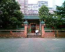 | |
Yuen Long District
| Location | Notes | Status | References | Photographs |
|---|---|---|---|---|
| Off Tai Shu Ha Road, Tai Kei Leng/Nga Yiu Tau, Shap Pat Heung |
Called the Tai Shu Ha Tin Hau Temple (大樹下天后廟), it got its name from being a Tin Hau Temple under a tree.[56] Probably built in 1786.[7] The celebration taking place there for the Birthday of Tin Hau is one of the biggest in the city.[57] | Grade II |  | |
| Wang Tat Road, Fung Chi Tsuen (鳳池村), Wang Chau |
Tin Hau Temple, Fung Chi Tsuen (鳳池村天后宮). Constructed before 1908.[7] | Grade I | 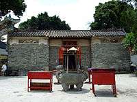 | |
| Tung Tau Tsuen, Yuen Long Kau Hui |
It is connected with the Kwun Yum Temple at the back, and they are considered as one complex.[58] | Grade III |  | |
| Off Deep Bay Road, Sha Kong Tsuen (沙江村), Ha Tsuen |
Tin Hau Temple, Sha Kong Tsuen (沙江天后廟). Originally built in the 1800s.[7] | Grade III |  | |
| Wing Ping Tsuen (永平村), San Tin |
Called the Tung Shan Temple (東山古廟), it is dedicated to Tin Hau. It underwent a renovation in 1894. It is the village alliance temple of all the Man (文) in San Tin.[59] | Grade III |  | |
| No.62 Shui Mei Tsuen (水尾村), Kam Tin |
It is believed that the temple was built between 1662–1722 and rebuilt in 1936.[7] | Grade III |  | |
| Ng Uk Tsuen (吳屋村), Wang Chau |
Tin Hau Temple, Tai Tseng Wai (大井圍天后古廟). Rebuilt in 1981.[60] | Not listed |  | |
| Nam Hang Pai (南坑排), Shap Pat Heung, off Tai Tong Road |
Located along Yuen Tsuen Ancient Trail. | Not listed | 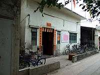 | |
| Ha Pak Nai |
Not listed | 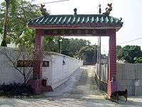 | ||
| Fung Kat Heung (逢吉鄉) |
Not listed |  | ||
| On top of a hill, off Hung Ting Road (洪天路), Hung Shui Kiu |
Tin Hau Temple, Hung Shui Kiu (洪水橋天后廟) | Not listed | On top of the hill on the right of Hung Ting Road => |
 |
| Mai Po Lung Tsuen, San Tin |
Located next to Shek Wu Wai Heroes Temple (米埔隴 英雄古廟) | Not listed |  | |
| Ma Tin Pok (馬田壆) |
Not listed |  | ||
See also
References
- ↑ Antiquities and Monuments Office: Tin Hau Temple, Causeway Bay
- ↑ Chinese Temples Committee: Tin Hau Temple, Joss House Bay
- ↑ Chan, Tin-kuen, Anthony (September 2006). Parade for the queen: safeguarding the intangible heritage of the Tin Hau Sea Ritual in Leung Shuen Wan, Sai Kung (Postgraduate thesis, Master of Science in Conservation). University of Hong Kong.
- ↑ Antiquities and Monuments Office. Brief Information on Proposed Grade III Items. Item #617. Tin Hau Temple, Leung Shuen Wan, Sai Kung Archived 2013-09-22 at the Wayback Machine.
- ↑ Birthday of Tin Hau: Unique Experiences
- 1 2 Siu Kwok Kin, Anthony (1996). "Distribution of Temples on Hong Kong Island as Recorded in 1981" (PDF). Journal of the Royal Asiatic Society Hong Kong Branch. 36: 241–245. ISSN 1991-7295.
- 1 2 3 4 5 6 7 8 9 10 11 12 13 14 15 16 17 18 19 20 21 22 23 24 25 26 27 28 Historic Building Appraisal: Introduction to 1444 Historic Buildings
- ↑ Chinese Temples Committee: Tin Hau Temple, Shau Kei Wan
- ↑ Hong Kong Housing Authority: Heritage Impact Assessment on Chai Wan Factory Estate at No. 2 Kut Shing Street, Chai Wan, Hong Kong, p.31, April 2013
- 1 2 3 4 Lonely Planet: Tin Hau Temples of Cheung Chau
- ↑ Historic Building Appraisal: Tin Hau Temple, Fan Lau Miu Wan, Fan Lau
- 1 2 3 4 5 6 7 8 Siu, Anthony K.K. (1980). "Distribution of temples on Lantau Island as recorded in 1979" (PDF). Journal of the Royal Asiatic Society Hong Kong Branch. Vol. 20: 136–139. ISSN 1991-7295.
- ↑ Fung Shui of San Tsuen Tin Hau Temple, pp.14-15
- ↑ Historic Building Appraisal: Tin Hau Temple, Kat Hing Back Street, Tai O
- ↑ Historic Building Appraisal: Tin Hau Temple, Sha Lo Wan, Tung Chung
- ↑ Geology of Chek Lap Kok. Chapter 8. 1994
- ↑ Exploring Islands - Tung Chung Archived 2012-10-27 at WebCite
- ↑ Historic Building Appraisal: Tin Hau Temple, Nim Shue Wan, Lantau
- ↑ Environmental Impact Assessment Report for 132 KV Supply Circuit from Pui O via Chi Ma Wan Peninsula via Sea Crossing towards Cheung Chau. Cultural Heritage. 2001
- ↑ Historic Building Appraisal: Introduction to 1444 Historic Buildings, p.873
- ↑ Tin Hau Temple, Yung Shue Wan
- ↑ Historic Building Appraisal: Tin Hau Temple, Po Toi Island
- ↑ Islands District Council. Paper No. IDC 107/2008 Archived 2011-07-21 at the Wayback Machine.
- ↑ Liquefied Natural Gas (LNG) Receiving Terminal and Associated Facilities. EIA Report. Section 12 Cultural Heritage Assessment. December 22, 2006
- ↑ A Commercial Scale Wind Turbine Pilot Demonstratrion at Hei Ling Chau. EIA Report. November 2006
- ↑ Historic Building Appraisal: Tin Hau Temple, No. 49 Ha Heung Road, To Kwa Wan
- ↑ Comprehensive Feasibility Study for the revised scheme South East Kowloon Development, EIA Report, 12.7 Proposed Mitigation Measures
- ↑ Kwai Tsing District Council website (archive)
- ↑ Welcome to 18 Districts - Kwai Tsing District
- ↑ Kwai Tsing: Hong Kong's nucleus of trade Archived 2011-09-27 at the Wayback Machine.
- ↑ Fun in Kwun Tong - Heritage & Attractions
- ↑ Public procession for the opening ceremony of Tin Hau Temple, Po Lam Road
- ↑ Historic Building Appraisal: Tin Hau Temple, Sai O, Kat O
- ↑ Welcome to 18 Districts - North District
- ↑ Historic Building Appraisal: Tin Hau Temple, Muk Wu Tsuen
- ↑ Historic building appraisal: Tin Hau Temple, No. 41 Hung Kiu San Tsuen, Sheung Shui
- ↑ East Rail Extension Project: Test Pits Results and Cross-Section Drawings
- ↑ Lonely Planet: Ping Kong
- ↑ Hong Kong (& Macau) Film Stuff: Project A - Jackie Chan (1983)
- ↑ Historic Building Appraisal: Introduction to 1444 Historic Buildings. Item #1111
- ↑ P.H. Hase, "The Historical Heritage of Ho Chung, Pak Kong, and Sha Kok Mei, Sai Kung", June 2003.
- ↑ The Tai Po Book, p.41 Archived 2011-06-09 at the Wayback Machine.
- ↑ Historic Building Appraisal: Tin Hau Temple, Fong Ma Po, Lam Tsuen
- 1 2 Wong Wing Ho, "Towards Urbanisation: Shuen Wan and Plover Cove Reservoir", Tai Po Book p. 239 Archived 2009-07-18 at the Wayback Machine.
- ↑ "船灣三宮廟修復重光", The Sun, 7 December 2009 (in Chinese)
- ↑ Historic Building Appraisal: Tin Hau Temple, Ha Wai, Tap Mun
- ↑ Historic Building Appraisal: Shui Yuet Kung, Ha Wai, Tap Mun
- ↑ Historic Building Appraisal: Tin Hau Temple, Sha Tau, Ping Chau
- ↑ Historic Building Appraisal: Tin Hau Temple, Wai Tsuen Road, Tsuen Wan
- ↑ Drainage Improvement in Tsuen Wan and Kwai Chung - Tsuen Wan Drainage Tunnel. Built Heritage and Historic Survey. May 2004
- 1 2 3 Welcome to 18 Districts - Tuen Mun District
- ↑ Film Services Office - Tin Hau Temple (Hau Kok)
- ↑ Historic Building Appraisal: Introduction to 1444 Historic Buildings, p.1355
- ↑ Consultancy Agreement No. NEX/2213. Environmental Impact Assessment (EIA) Study for Shatin to Central Link - Hung Hom to Admiralty Section. Appendix 4.1 Cultural Heritage Baseline Report, p.2. MTR Corporation Limited (archive)
- ↑ Historic Building Appraisal: Tin Hau Temple, Temple Street, Yau Ma Tei
- ↑ Welcome to 18 Districts - Yuen Long District
- ↑ Tin Hau Festival and Tin Hau Temples, 2017
- ↑ Historic Building Appraisal: Tin Hau Temple, Tung Tau Tsuen, Yuen Long
- ↑ Historic Building Appraisal: Tung Shan Temple, Wing Ping Tsuen, San Tin
- ↑ Cultural Heritage Impact Assessment, p.10-6
External links
| Wikimedia Commons has media related to Tin Hau temples in Hong Kong. |
- Tsui, Enid (24 April 2016). "Why Hong Kong makes such a big deal of sea goddess Tin Hau's birthday". South China Morning Post.