Tidworth
| Tidworth | |
|---|---|
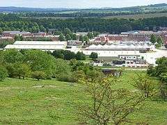 Tidworth Camp: a view over the garrison from Clarendon Hill | |
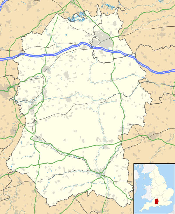 Tidworth Tidworth shown within Wiltshire | |
| Population | 10,621 (in 2011)[1] |
| OS grid reference | SU2348 |
| Unitary authority | |
| Ceremonial county | |
| Region | |
| Country | England |
| Sovereign state | United Kingdom |
| Post town | TIDWORTH |
| Postcode district | SP9 |
| Dialling code | 01980 |
| Police | Wiltshire |
| Fire | Dorset and Wiltshire |
| Ambulance | South Western |
| EU Parliament | South West England |
| UK Parliament | |
| Website | Town Council |
Tidworth is a garrison town and civil parish in south-east Wiltshire, England, located along the A338 and close to the A303. Situated at the eastern edge of Salisbury Plain, it is approximately 10 miles (16 km) west of Andover, 12 miles (19 km) south of Marlborough, 24 miles (39 km) south of Swindon, 15 miles (24 km) north by north-east of Salisbury and 6 miles (9.7 km) east of Amesbury. The population of the parish at the 2011 census was approximately 10,600.[1]
History
Tidworth was listed in the Domesday Book as Todeorde, in the Andover Hundred, in "Hantscire". It was once the family home of the Studd family. On John Speed's maps (1611), the town is referred to as Tudworth, North Tudworth belonging to Amesbury hundred in "Wilshire", and South Tudworth to Andover hundred in "Hamshire".
When the boundary between Wiltshire and Hampshire was redrawn in 1992, the distinction between North Tidworth and South Tidworth vanished, and the entire town became part of Wiltshire, though remaining part of the Hampshire postal county. The two parts remained as separate civil parishes until 1 April 2004.
Armed forces
In recent years the population of the town has increased as Tidworth Camp has expanded. The population of Tidworth will continue to increase with the implementation of the Army Basing Plan leading up to 2020.
Governance
The parish elects a town council. The parish includes the village of Perham Down. It is in the area of Wiltshire Council unitary authority, which is responsible for most local government functions.
An electoral ward exists with the same name. The population of the ward taken at the 2011 census was 9,174.[2]
Today
Its situation near the A303, and hence the M3, places Tidworth within commuting distance of London.
Tidworth has a small commercial area containing two supermarkets (a Lidl and a large Tesco), two veterinary surgeries, a pharmacy, and other shops and services. A dental surgery serves Tidworth and the surrounding area, covering approximately 5,000 people. In 2003 a new medical centre was completed, the cost being split between the Ministry of Defence and the NHS, as it serves the armed forces and their dependants within the surrounding area.
Tidworth has one of the lowest crime rates per thousand in Wiltshire, and between the years of 1990 and 2004 only one major crime took place.[3] In 2014, it was rated by the Royal Mail as the most attractive postcode area to live in in England.[4]
Education
The community is served by three primary schools and an infant school.
The Wellington Academy, which was partly sponsored by Wellington College, opened in September 2009, replacing Castledown School. The academy has a sixth form college, an all-weather sports pitch, and dedicated Combined Cadet Force facilities. The parent unit of the CCF is 26 Royal Engineers, housed nearby at Swinton Barracks.[5] The local garrison commander is a governor of the academy.
Religious sites
The Anglican Church of the Holy Trinity was rebuilt in the 15th century on the site of a church from the 12th or 13th centuries.[6][7] It is Grade II* listed.[8]
The Roman Catholic Church of St George and St Patrick, North Tidworth, was built in 1912.[9][10]

St Mary's Church, South Tidworth was built in 1878. It is Grade I listed[11] and is now in the care of the Churches Conservation Trust.[12]
Culture
- The musician James Blunt was born in Tidworth.
- The Studd family of the Ashes fame owned and lived in Tedworth House.
- Tidworth Polo Club is the second largest in the country and frequently plays host to royals such as Princes William and Harry.
- Tidworth Garrison Golf Club was constructed in 1904 initially for use by army officers. It was established in 1908 and gradually made available to all ranks and civilians. In 2000 it became a limited company.[13]
References
- 1 2 "Wiltshire Community History - Census". Wiltshire Council. Retrieved 30 May 2015.
- ↑ "Ward population 2011". Office for National Statistics. Retrieved 16 March 2015.
- ↑ "Tidworth". UK Crime Stats.
- ↑ "UK's 'most desirable' postcodes revealed". BBC News. 25 August 2014.
- ↑ "Combined Cadet Force (CCF)". The Wellington Academy. Archived from the original on 20 December 2015. Retrieved 20 January 2016.
- ↑ "Holy Trinity Church, Tidworth". Wiltshire Community History. Wiltshire Council. Retrieved 30 May 2015.
- ↑ "Holy Trinity, Tidworth". A Church Near You. Archbishops' Council. Retrieved 30 May 2015.
- ↑ Historic England. "Church of the Holy Trinity, Tidworth (1036009)". National Heritage List for England. Retrieved 30 May 2015.
- ↑ "Roman Catholic Church of St. George and St. Patrick, North Tidworth". Wiltshire Community History. Wiltshire Council. Retrieved 30 May 2015.
- ↑ "SS Patrick & George, Tidworth". Catholic Directory. Retrieved 30 May 2015.
- ↑ Historic England. "Church of St Mary, Tidworth (1093240)". National Heritage List for England. Retrieved 30 May 2015.
- ↑ "St Mary, South Tidworth". Churches Conservation Trust. Retrieved 16 October 2010.
- ↑ "About Tidworth". Tidworth Garrison Golf Club.
Further reading
- Crowley, D.A., ed. (1995). "Victoria County History: Wiltshire: Vol 15 pp153-163 - Parishes: North Tidworth". British History Online. University of London. Retrieved 1 August 2018.
- Page, William, ed. (1911). "Victoria County History: Hampshire: Vol 4 pp391-394 - Parishes: Tidworth, South". British History Online. University of London. Retrieved 1 August 2018.
External links
- Tidworth Town Council
- Tidworth Festival
- Tidworth Polo Club
- Tedworth Hunt
- The Wellington Academy
- Tidworth Garrison Golf Club
| Unitary authorities | |
|---|---|
| Major settlements | |
| Rivers | |
| Topics | |