River Wylye
| River Wylye | |
| River | |
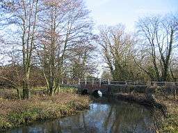 River Wylye at Norton Bavant | |
| Country | England |
|---|---|
| Tributaries | |
| - left | Chitterne Brook, River Till |
| Cities | Maiden Bradley, Warminster, Codford St Peter, Wilton |
| Source | Rodmead Farm |
| - location | Maiden Bradley, Wiltshire, England |
| - elevation | 148 m (486 ft) |
| - coordinates | 51°07′25″N 2°18′11″W / 51.12361°N 2.30306°W |
| Mouth | Confluence with River Nadder |
| - location | Wilton, Wiltshire, England |
| - elevation | 69 m (226 ft) |
| - coordinates | 51°04′45″N 1°51′45″W / 51.07917°N 1.86250°WCoordinates: 51°04′45″N 1°51′45″W / 51.07917°N 1.86250°W |
| Length | 45 km (28 mi) |
| Basin | 470 km2 (181 sq mi) |
| Discharge | for Chitterne Brook |
| - average | 0.3 m3/s (11 cu ft/s) |
| - max | 0.6 m3/s (21 cu ft/s) |
| - min | 0.1 m3/s (4 cu ft/s) |
The River Wylye (/ˈwaɪli/ WY-lee) is a southern England chalk stream, with clear water flowing over gravel. It is popular with anglers for fly fishing.[1] A half-mile stretch of the river and three lakes in Warminster are a local nature reserve.[2][3]
Course
The Wylye rises below the White Sheet Downs just south of Maiden Bradley in the west of Wiltshire, then flows north through the Deverill valley. A tributary which feeds the man-made Shearwater lake joins near Crockerton.[4] On the southern edge of Warminster the river turns to head generally east south east, forming the Wylye Valley, into which the A36 road and the Wessex Main Line are also squeezed. The river passes through the parishes of Norton Bavant, Heytesbury, Knook, Upton Lovell, Boyton, Codford, Wylye and Wilton, near the southern edge of Salisbury Plain. It is fed by ephemeral, winterbourne streams so water flow can vary.[5]
The river forms part of the River Avon catchment. At Wilton it joins the River Nadder and eventually drains to the sea at Christchurch as part of the Avon.
Features
Two SSSIs are associated with the river:[6] Steeple Langford Down and Wylye and Church Dean Downs.
A vineyard is located near the river's source.[7]
The Wylye valley is dotted with small chocolate box villages composed of thatched cottages and stone-built pubs.
Name
Wilton, and hence Wiltshire (which was originally Wiltonshire), are named after the river. There is also a village of Wylye.
In literature
The River Wylye forms one of the five rivers referred to in the novel Sarum.
Villages
The villages located on the River Wylye include (source to confluence):
References
- ↑ "Fishing Breaks". Retrieved 20 November 2007.
- ↑ "River Wylye". Local Nature Reserves. Natural England.
- ↑ "Map of River Wylye". Local Nature Reserves. Natural England.
- ↑ "Wylye (Headwaters)". Environment Agency - Catchment Data Explorer. Retrieved 18 March 2018.
- ↑ "IUCN" (PDF). Archived from the original (PDF) on 14 December 2007. Retrieved 20 November 2007.
- ↑ "English Nature". Retrieved 20 November 2007.
- ↑ "W Wilts Tourism". Archived from the original on 28 September 2007. Retrieved 20 November 2007.
- ↑ "The Village of Sutton Veny, Wylye Valley". Retrieved 13 June 2008.
Sources
| Unitary authorities | |
|---|---|
| Major settlements | |
| Rivers | |
| Topics | |