Tennessee State Route 28
| ||||
|---|---|---|---|---|
| Route information | ||||
| Maintained by TDOT | ||||
| Length | 132.37 mi (213.03 km) | |||
| Major junctions | ||||
| South end |
| |||
|
| ||||
| North end |
| |||
| Location | ||||
| Counties | Marion, Sequatchie, Bledsoe, Cumberland, Fentress, Pickett | |||
| Highway system | ||||
| ||||

State Route 28 (SR 28) is a state highway in the state of Tennessee, traversing the state in a north–south axis from south of Jasper to the Kentucky state line at Static.[1]
Route description
Marion County
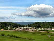
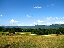
SR 28 begins just south of Jasper at an interchange with I-24/SR 27 (Exit 155) in Marion County. It then goes north as a 4-lane divided highway to have an interchange with US 41/US 64/US 72/SR 2 in Jasper before bypassing downtown to the east and continuing north and narrowing to a 2-lane. It then passes through Sequatchie before entering Whitwell at an intersection with SR 283. It then has an intersection with SR 108 before going through downtown and leaving Whitwell to go down a long, narrow valley full of farmland. SR 28 then crosses into Sequatchie County.
Sequatchie County
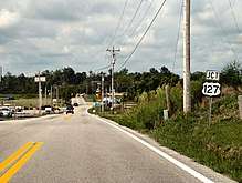
SR 28 then goes north to enter Dunlap and have a y-intersection with US 127/SR 8. From this point on, SR 28 is the unsigned companion route of US 127 from Dunlap to the state line at Static. US 127/SR 8/SR 28 then go north through downtown to an interchange with SR 111, with SR 8 splitting off here to go west on SR 111. US 127/SR 28 then go through some farmland before entering Bledsoe County.
Bledsoe County
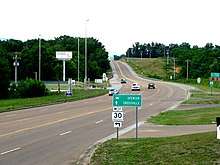
They then pass through Palio, Lusk, and Lees Station before entering Pikeville at an intersection with SR 30. They then become concurrent with each other through downtown before splitting off to the west, with US 127/SR 28 continuing north through farmland to pass through Cold Spring and Melvine before crossing some mountains to enter the Cumberland Plateau and Cumberland County.
Cumberland County
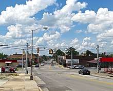
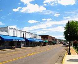
US 127/SR 28 immediately have an intersection with SR 282. They then go through more farmland before passing by Cumberland Mountain State Park and having an intersection with SR 419. They then come to a y-intersection with SR 68, where US 127/SR 28 turn northeast to enter Crossville. They then intersect SR 392 (a beltway around downtown) before entering downtown and having an intersection with US 70/SR 1/SR 101. They then pass through downtown before widening to a 4-lane and junctioning with SR 298. US 127/SR 28 then have an intersection with US 70N/SR 24 before going through Crossville's main business district before crossing the Obed River and coming to an interchange with I-40 (Exit 317). US 127/SR 28 then leave Crossville and continue north through more farmland. They then cross into Fentress County via a couple of sharp switchbacks, in order to negotiate a bridge over Clear Creek.
Fentress County
US 127/SR 28 then go through more farmland before entering Clarkrange to have an intersection with SR 62. US 127/SR 28 then passes through Clarkrange before having an intersection with SR 85 and entering Grimsley. They then pass through Grimsley before widening to a 4-lane and intersecting SR 296 west of Allardt. They then enter Jamestown and bypass downtown (beginning with the intersection with Main Street (Old US 127/SR 28) to the east and have an interchange with SR 52 before having one with SR 154. They then leave Jamestown, at the other end of Main Street (Old US 127/SR 28), and continue north and narrowing to a 2-lane. They then pass through Sgt. Alvin C. York State Historic Park and Pall Mall before crossing into Pickett County.
Pickett County
They intersect with SR 325 and then SR 295 before entering Static and intersecting SR 111 immediately before crossing the state line into Kentucky, with SR 28 ending here and US 127 continuing into Kentucky.[1][2]
Major Intersections
Marion County


Sequatchie County
Bledsoe County
Cumberland County


Fentress County


- South Main Street in Jamestown (Old US 127/SR 28 through downtown)


- North York Highway north of Jamestown (Old US 127/SR 28 through downtown)
Pickett County


References
- 1 2 DeLorme (2004). Tennessee Atlas & Gazetteer (Map). Yarmouth, ME: DeLorme.
- ↑ Tennessee Department of Transportation (2015). Official Tennessee Highway Map (Map). Nashville: Tennessee Department of Transportation.