Te Teko
| Te Teko | |
|---|---|
 Te Teko | |
| Coordinates: 38°02′10″S 176°47′46″E / 38.03611°S 176.79611°E | |
| Country |
|
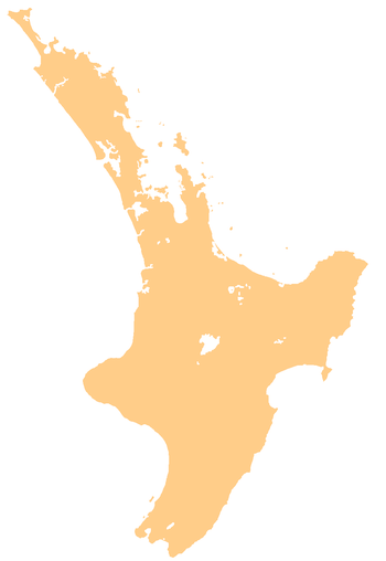
| Region | Bay of Plenty |
| Territorial authority | Whakatāne District |
| Ward | Rangitāiki |
| Population (2006)[1] | |
| • Total | 627 |
Te Teko is a small inland township in the Bay of Plenty region of New Zealand's North Island. According to the 2006 New Zealand census, its population is 627, a decrease of 3 from the previous census in 2001.[2]
Geography
The Rangitaiki River passes through the town as it flows northwards to its mouth on the Pacific Ocean, and State Highways 30 and 34 meet in the town. SH 30 cuts through the town on its route from Whakatane to Rotorua, while SH 34 crosses it in the town's west and runs southwest to Kawerau. To the west of the town runs the East Coast Main Trunk Railway, and from it diverges the Murupara Branch line, which skirts the south of Te Teko.
Te Teko has the highest mean daily maximum temperature (20.26 °C) of any settlement in New Zealand, although it is not the warmest town in New Zealand as the mean daily minimum temperature of 8.56 °C is comparatively low. Rainfall is high, averaging 1474mm per year.[3]
History
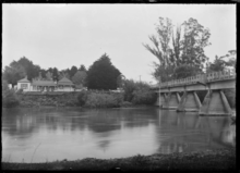
In the mid-1860s, Te Teko was the site of a significant siege on a Māori pā as part of the East Cape War.[4] After peace came to the region, a hotel was established on the banks of the Rangitaiki River in 1879 and Te Teko rose in importance as a boat service was established to ferry hotel customers and travellers across the river. A bridge made the boat service redundant in 1915.[5]
The present day township of Te Teko includes a racecourse, golf course, police station,[6] and a primary school.[7] The primary school was established in 1881.[8]
Demographics
95.2% of the town's population identify as Māori, one of the highest percentages whereas Māori comprise 14.7% of the national population.[9] 47% of the population speak the Māori language, compared to 9.4% for the entire Bay of Plenty region. The town's unemployment rate of 22.5% is dramatically higher than the regional average of 6.1% and the national average of 5.1%, and the 2006 median income was $NZ7,700 below the regional median of $22,600 [2]
References
- ↑ "Subnational Population Estimates: At 30 June 2018 (provisional)". Statistics New Zealand. 23 October 2018. Retrieved 23 October 2018. For urban areas, "Subnational population estimates (UA, AU), by age and sex, at 30 June 1996, 2001, 2006-18 (2018 boundary)". Statistics New Zealand. 23 October 2018. Retrieved 23 October 2018.
- 1 2 Quickstats about Te Teko
- ↑ Climate charts for Te Teko
- ↑ The New Zealand Wars: A History of the Maori Campaigns and the Pioneering Period: Volume II: The Hauhau Wars, 1864–72 by James Cowan, F.R.G.S.
- ↑ Te Ara encyclopedia of NZ Archived 2007-09-27 at the Wayback Machine.
- ↑ Zoomin.co.nz map
- ↑ Te Kete Ipurangi schools database
- ↑ Te Ara Encyclopedia of NZ
- ↑ People may select more than one ethnicity, so percentages add to more than 100%. 19.7% identify as European
Coordinates: 38°02′10″S 176°47′46″E / 38.0361°S 176.7961°E