Tapul, Sulu
| Tapul | |
|---|---|
| Municipality | |
| Municipality of Tapul | |
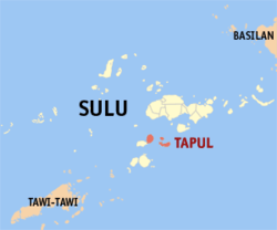 Map of Sulu with Tapul highlighted | |
.svg.png) Tapul Location within the Philippines | |
| Coordinates: 5°43′00″N 120°54′00″E / 5.7166667°N 120.9°ECoordinates: 5°43′00″N 120°54′00″E / 5.7166667°N 120.9°E | |
| Country |
|
| Region | Autonomous Region in Muslim Mindanao (ARMM) |
| Province | Sulu |
| District | 2nd District |
| Barangays | 15 (see Barangays) |
| Government [1] | |
| • Type | Sangguniang Bayan |
| • Mayor | Nasser Daud |
| • Electorate | 7,905 voters (2016) |
| Area [2] | |
| • Total | 89.17 km2 (34.43 sq mi) |
| Population (2015 census)[3] | |
| • Total | 18,197 |
| • Density | 200/km2 (530/sq mi) |
| Time zone | UTC+8 (PST) |
| ZIP code | 7410 |
| PSGC | 156614000 |
| IDD : area code | +63 (0)68 |
| Climate type | Tropical climate |
| Income class | 5th municipal income class |
| Revenue (₱) | 56,550,816.00 (2016) |
| Native languages |
Tausug Tagalog |
| Website |
www |
Tapul, officially the Municipality of Tapul, is a 5th class municipality in the province of Sulu, Philippines. According to the 2015 census, it has a population of 18,197 people.[3]
Barangays
Tapul is politically subdivided into 15 barangays.
- Alu-Kabingaan
- Banting
- Hawan
- Kalang (Poblacion)
- Kamaunggi
- Kanaway
- Kanmangon
- Kaumpang
- Pagatpat
- Pangdan
- Puok
- Sayli
- Sumambat
- Tangkapaan
- Tulakan
Demographics
| Population census of Tapul | ||
|---|---|---|
| Year | Pop. | ±% p.a. |
| 1903 | 7,440 | — |
| 1918 | 7,358 | −0.07% |
| 1939 | 18,496 | +4.49% |
| 1948 | 16,601 | −1.19% |
| 1960 | 18,577 | +0.94% |
| 1970 | 20,694 | +1.08% |
| 1975 | 28,340 | +6.51% |
| 1980 | 23,472 | −3.70% |
| 1990 | 10,111 | −8.08% |
| 1995 | 12,392 | +3.89% |
| 2000 | 14,881 | +4.00% |
| 2007 | 17,430 | +2.20% |
| 2010 | 16,370 | −2.26% |
| 2015 | 18,197 | +2.03% |
| Source: Philippine Statistics Authority[3][4][5] | ||
References
- ↑ "Municipality". Quezon City, Philippines: Department of the Interior and Local Government. Retrieved 31 May 2013.
- ↑ "Province: Sulu". PSGC Interactive. Quezon City, Philippines: Philippine Statistics Authority. Retrieved 12 November 2016.
- 1 2 3 Census of Population (2015). "ARMM – Autonomous Region in Muslim Mindanao". Total Population by Province, City, Municipality and Barangay. PSA. Retrieved 20 June 2016.
- ↑ Census of Population and Housing (2010). "ARMM – Autonomous Region in Muslim Mindanao". Total Population by Province, City, Municipality and Barangay. NSO. Retrieved 29 June 2016.
- ↑ Censuses of Population (1903–2007). "ARMM – Autonomous Region in Muslim Mindanao". Table 1. Population Enumerated in Various Censuses by Province/Highly Urbanized City: 1903 to 2007. NSO.
External links
- Philippine Standard Geographic Code
- Philippine Census Information
- Local Governance Performance Management System
Jolo (capital) | |
| Municipalities | |
This article is issued from
Wikipedia.
The text is licensed under Creative Commons - Attribution - Sharealike.
Additional terms may apply for the media files.