Hadji Panglima Tahil, Sulu
| Hadji Panglima Tahil | |
|---|---|
| Municipality | |
| Municipality of Hadji Panglima Tahil | |
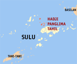 Map of Sulu with Hadji Panglima Tahil highlighted | |
.svg.png) Hadji Panglima Tahil Location within the Philippines | |
| Coordinates: 6°10′N 120°55′E / 6.17°N 120.92°ECoordinates: 6°10′N 120°55′E / 6.17°N 120.92°E | |
| Country |
|
| Region | Autonomous Region in Muslim Mindanao (ARMM) |
| Province | Sulu |
| District | 1st District |
| Barangays | 5 (see Barangays) |
| Government [1] | |
| • Type | Sangguniang Bayan |
| • Mayor | Abraham Burahan |
| • Electorate | 4,172 voters (2016) |
| Area [2] | |
| • Total | 67.90 km2 (26.22 sq mi) |
| Population (2015 census)[3] | |
| • Total | 6,375 |
| • Density | 94/km2 (240/sq mi) |
| Time zone | UTC+8 (PST) |
| ZIP code | 7413 |
| PSGC | 156606000 |
| IDD : area code | +63 (0)68 |
| Climate type | Tropical climate |
| Income class | 6th municipal income class |
| Revenue (₱) | 37,987,295.83 (2016) |
| Native languages |
Tausug Tagalog |
| Website |
www |
Hadji Panglima Tahil, officially the Municipality of Hadji Panglima Tahil, is a 6th class municipality in the province of Sulu, Philippines. According to the 2015 census, it has a population of 6,375 people.[3]
It is formerly known as Marunggas.
As of 2000, it was the poorest municipality in the Philippines with a poverty incidence estimate of 89.7%.[4]
Barangays
Hadji Panglima Tahil is politically subdivided into 5 barangays.
- Bangas (Poblacion)
- Bubuan
- Kabuukan
- Pag-asinan
- Teomabal
Demographics
| Population census of Hadji Panglima Tahil | ||
|---|---|---|
| Year | Pop. | ±% p.a. |
| 1903 | 267 | — |
| 1918 | 4,296 | +20.35% |
| 1939 | 1,998 | −3.58% |
| 1948 | 1,850 | −0.85% |
| 1960 | 671 | −8.10% |
| 1970 | 1,341 | +7.16% |
| 1975 | 4,178 | +25.60% |
| 1980 | 4,325 | +0.69% |
| 1990 | 4,153 | −0.41% |
| 1995 | 4,419 | +1.17% |
| 2000 | 5,314 | +4.03% |
| 2007 | 6,192 | +2.13% |
| 2010 | 5,850 | −2.05% |
| 2015 | 6,375 | +1.65% |
| Source: Philippine Statistics Authority[3][5][6][7] | ||
References
- ↑ "Municipality". Quezon City, Philippines: Department of the Interior and Local Government. Retrieved 31 May 2013.
- ↑ "Province: Sulu". PSGC Interactive. Quezon City, Philippines: Philippine Statistics Authority. Retrieved 12 November 2016.
- 1 2 3 Census of Population (2015). "ARMM – Autonomous Region in Muslim Mindanao". Total Population by Province, City, Municipality and Barangay. PSA. Retrieved 20 June 2016.
- ↑
- ↑ Census of Population and Housing (2010). "ARMM – Autonomous Region in Muslim Mindanao". Total Population by Province, City, Municipality and Barangay. NSO. Retrieved 29 June 2016.
- ↑ Censuses of Population (1903–2007). "ARMM – Autonomous Region in Muslim Mindanao". Table 1. Population Enumerated in Various Censuses by Province/Highly Urbanized City: 1903 to 2007. NSO.
- ↑ "Province of Sulu". Municipality Population Data. Local Water Utilities Administration Research Division. Retrieved 17 December 2016.
External links
- Philippine Standard Geographic Code
- Philippine Census Information
- Local Governance Performance Management System
Places adjacent to Hadji Panglima Tahil, Sulu | |
|---|---|
Jolo (capital) | |
| Municipalities | |
This article is issued from
Wikipedia.
The text is licensed under Creative Commons - Attribution - Sharealike.
Additional terms may apply for the media files.