Kalingalan Caluang, Sulu
| Kalingalan Caluang | |
|---|---|
| Municipality | |
| Municipality of Kalingalan Caluang | |
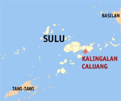 Map of Sulu with Kalingalan Caluang highlighted | |
.svg.png) Kalingalan Caluang Location within the Philippines | |
| Coordinates: 5°53′N 121°16′E / 5.88°N 121.27°ECoordinates: 5°53′N 121°16′E / 5.88°N 121.27°E | |
| Country |
|
| Region | Autonomous Region in Muslim Mindanao (ARMM) |
| Province | Sulu |
| District | 2nd District |
| Barangays | 9 (see Barangays) |
| Government [1] | |
| • Type | Sangguniang Bayan |
| • Mayor | Peping K. Halun |
| • Electorate | 12,160 voters (2016) |
| Area [2] | |
| • Total | 166.50 km2 (64.29 sq mi) |
| Population (2015 census)[3] | |
| • Total | 31,567 |
| • Density | 190/km2 (490/sq mi) |
| Time zone | UTC+8 (PST) |
| ZIP code | 7416 |
| PSGC | 156603000 |
| IDD : area code | +63 (0)68 |
| Climate type | Tropical climate |
| Income class | 5th municipal income class |
| Revenue (₱) | 66,869,430.30 (2016) |
| Native languages |
Tausug Tagalog |
Kalingalan Caluang, officially the Municipality of Kalingalan Caluang, is a 5th class municipality in the province of Sulu, Philippines. According to the 2015 census, it has a population of 31,567 people.[3]
Barangays
Kalingalan Caluang is politically subdivided into 9 barangays.
- Kambing
- Kanlagay
- Karungdong (Poblacion)
- Masjid Bayle
- Masjid Punjungan
- Pang
- Pangdan Pangdan
- Pitogo
- Tunggol
Demographics
| Population census of Kalingalan Caluang | ||
|---|---|---|
| Year | Pop. | ±% p.a. |
| 1980 | 8,639 | — |
| 1990 | 15,824 | +6.24% |
| 1995 | 19,320 | +3.81% |
| 2000 | 22,688 | +3.50% |
| 2007 | 30,046 | +3.95% |
| 2010 | 26,848 | −4.01% |
| 2015 | 31,567 | +3.13% |
| Source: Philippine Statistics Authority[3][4][5][6] | ||
References
- ↑ "Municipality". Quezon City, Philippines: Department of the Interior and Local Government. Retrieved 31 May 2013.
- ↑ "Province: Sulu". PSGC Interactive. Quezon City, Philippines: Philippine Statistics Authority. Retrieved 12 November 2016.
- 1 2 3 Census of Population (2015). "ARMM – Autonomous Region in Muslim Mindanao". Total Population by Province, City, Municipality and Barangay. PSA. Retrieved 20 June 2016.
- ↑ Census of Population and Housing (2010). "ARMM – Autonomous Region in Muslim Mindanao". Total Population by Province, City, Municipality and Barangay. NSO. Retrieved 29 June 2016.
- ↑ Censuses of Population (1903–2007). "ARMM – Autonomous Region in Muslim Mindanao". Table 1. Population Enumerated in Various Censuses by Province/Highly Urbanized City: 1903 to 2007. NSO.
- ↑ "Province of Sulu". Municipality Population Data. Local Water Utilities Administration Research Division. Retrieved 17 December 2016.
External links
- Philippine Standard Geographic Code
- Philippine Census Information
- Local Governance Performance Management System
Places adjacent to Kalingalan Caluang, Sulu | ||||||||||
|---|---|---|---|---|---|---|---|---|---|---|
| ||||||||||
Jolo (capital) | |
| Municipalities | |
This article is issued from
Wikipedia.
The text is licensed under Creative Commons - Attribution - Sharealike.
Additional terms may apply for the media files.