Tapeats Creek
| Tapeats Creek | |
|---|---|
|
Overhead view of lower section of Tapeats Creek | |
 Location of the mouth of Tapeats Creek | |
 Location of the mouth of Tapeats Creek in Arizona | |
| Native name | Ta Pits |
| Etymology | Southern Paiute Indian |
| Country | United States |
| State | Arizona |
| County | Coconino |
| Physical characteristics | |
| Main source |
Tapeats Spring[1] Grand Canyon (North Rim) 36°26′06″N 112°20′39″W / 36.435°N 112.3443°W |
| River mouth |
Colorado River[1] Grand Canyon (Canyon Floor) 1,985 feet (605 m) 36°22′14″N 112°28′10″W / 36.3705°N 112.4694°WCoordinates: 36°22′14″N 112°28′10″W / 36.3705°N 112.4694°W |
| Basin features | |
| Tributaries |
|
Tapeats Creek is a creek located entirely within the Grand Canyon National Park. It flows southwest from its source near the North Rim of the canyon to the Colorado River at the base of the canyon. It was named by the Second Powell Expedition in the winter of 1871–1872 for a Southern Paiute Indian who claimed ownership of the stream.[1][lower-alpha 1] It contributes the largest amount of water to the Colorado of any tributary on the north side within the Grand Canyon.[3]
Source
The creek is fed from Tapeats Spring, the largest Spring in the Grand Canyon. In 1970, the spring was estimated to discharge forty-eight million US gal (180,000,000 l; 40,000,000 imp gal) of water per day into the creek from the Muav Limestone. A small amount of surface water can also flow into the creek. Since the spring flows year round, the creek is a perennial stream.[4]
Tributaries
Tapeats Creek has one named tributary, Thunder River, a 0.5-mile (0.80 km) long river that begins where a natural spring (Thunder Springs) emerges at an elevation of 3,360 feet (1,020 m) and then drops by approximately 1,200 feet (370 m). The river, the steepest and one of the shortest in the United States, ends at the bottom of a waterfall where it joins Tapeats Creek.[5][6][lower-alpha 2]
Environment
Common trees along the creek are tamarisk and willows, with equisetum, mimulus, and cress found along the banks. Algae-covered rocks are found in most of the creek. Common aquatic invertebrate found in the creek include mayflies, different types of caddisflies, flies and riffle beetles. Bladder snails, isopods and damselflies can also be found.[7]
Fishing
The creek is considered one of Arizona’s best wild-trout streams. The creek can be reached by Thunder River Trail from the North Rim, which is only accessible from mid-May to late October. Alternatively, the creek can be reached by raft trip on the Colorado River. Rainbow trout are plentiful and average 12 inches (300 mm) and can reach 20 inches (510 mm).[8]
Related
The following geologic features are located in the vicinity and are named after the creek:
- the Tapeats Sandstone, which is exposed above the creek
- the Tapeats Rapids in the Colorado, located where the creek enters the river[9]
- Tapeats Amphitheater, a large basin containing the creek's headwaters[10]
- Tapeats Terrace, a terrace with wide low benches[11]
- Tapeats Spring, the natural spring that feeds the creek[12]
Notes
References
- 1 2 3 "Tapeats Creek". Geographic Names Information System. United States Geological Survey. Retrieved April 28, 2017.
- 1 2 Granger, Byrd H. (1976). Grand Canyon Place Names. Tucson: The University of Arizona Press. p. 23. ISBN 9780816505388. Retrieved April 30, 2017.
- ↑ Patrick, Ruth (2000). Rivers of the United States, Volume V Part A: The Colorado River. John Wiley & Sons. p. 58. ISBN 9780471303480. Retrieved April 30, 2017.
- ↑ Watkins, Conor; Rogers, J. David. "Landsliding And Channel Blockages In Tapeats Creek". mst.edu. Missouri University of Science & Technology. Retrieved April 30, 2017.
- ↑ "Thunder Springs and Thunder River, Grand Canyon National Park, Arizona". azheritagewaters. Northern Arizona University. Retrieved April 29, 2017.
- ↑ MacDonald, Douglas (Feb 2007). "Hike to the Grand Canyon's North Rim Waterfalls". Backpacker. 35 (246): 31. Retrieved April 29, 2017.
- ↑ Epstein, Dave; Purdy, Sabra; Campos, Brent. "Tapeats Creek: Habitat for Fish and Invertebrates" (PDF). University of California Davis. Retrieved April 30, 2017.
- ↑ Jordan, Will (July 2014). "Grand Canyon National Park, An Angler's Perspective". Southwest Fly Fishing. Retrieved April 29, 2017.
- ↑ "Tapeats Rapids". Geographic Names Information System. United States Geological Survey. Retrieved April 28, 2017.
- ↑ "Tapeats Amphitheater". Geographic Names Information System. United States Geological Survey. Retrieved April 28, 2017.
- ↑ "Tapeats Terrace". Geographic Names Information System. United States Geological Survey. Retrieved April 28, 2017.
- ↑ "Tapeats Spring". Geographic Names Information System. United States Geological Survey. Retrieved April 28, 2017.
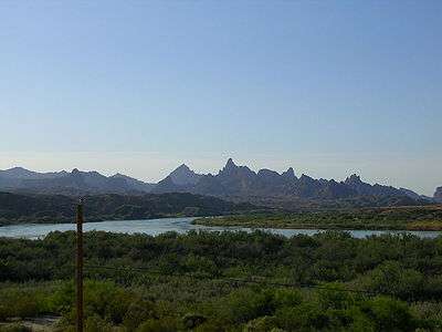
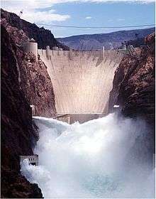
Colorado River system | |||||||||
|---|---|---|---|---|---|---|---|---|---|
| Jurisdictions |
|     | |||||||
| Canyons |
| ||||||||
| Natural features |
| ||||||||
| Tributaries | |||||||||
| Engineering |
| ||||||||
| Designated areas | |||||||||
| Related topics | |||||||||