Tadepalle, Guntur district
| Tadepalli | |
|---|---|
| Municipality | |
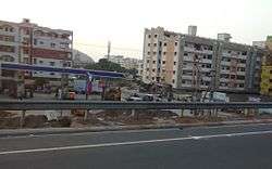 Residential area at Tadepalle near National Highway 16 | |
 Tadepalli Location in Andhra Pradesh, India | |
| Coordinates: 16°28′49″N 80°37′07″E / 16.48028°N 80.61861°ECoordinates: 16°28′49″N 80°37′07″E / 16.48028°N 80.61861°E | |
| Country | India |
| State | Andhra Pradesh |
| District | Guntur |
| Area[1] | |
| • Total | 25.45 km2 (9.83 sq mi) |
| Elevation[2] | 19 m (62 ft) |
| Population [3] | |
| • Total | 54,406 |
| • Density | 2,100/km2 (5,500/sq mi) |
| Languages | |
| • Official | Telugu |
| Time zone | UTC+5:30 (IST) |
| PIN | 522 501 |
| Vehicle registration | AP–07 |
Tadepalli Municipality is in Guntur district of the Indian state of Andhra Pradesh. The town lies on the south bank of the Krishna river and is the headquarters of Tadepalle mandal of Guntur revenue division. It lies in Andhra Pradesh Capital Region and a small portion of the town is a part of the state capital, Amaravati.[4]
Etymology
The origin of the name is believed to be related to the Palm tree 'Tathi' and 'palle' meaning village. Tadepalli is on the southern bank of the Krishna River and Vijayawada city. The Canal flowing through the town is named as Madras Kaluva(Buckingham Canal) – as it goes until Madras (Chennai). Tadepalli, along with Tenali was an 'Agraharam' – or endowed land to Sanskrit Scholars during the classical Sri Krishnadevaraya period.
Geography
Tadepalli is located at 16°28′00″N 80°36′00″E / 16.4667°N 80.6000°E.[5] It has an average elevation of 6 meters (22 feet). Total municipality contains hill area and agricultural lands. Buckingham canal Flows from north to south in the region. Municipality contains old industrial lands, belongs to EID parry company and cement factory which are not being used for any purpose.
Demographics
As of 2011 census of India, Tadepalli had a population of 54,406, with number of households accounting to 14392. The total population constitutes 27,149 males, 27,257 females and 6,078 under 6 years of age. The sex ratio stands at 1004 females per 1000 males. There are 36,694 literates with an average literacy rate of 75.93%, significantly higher than the state average of 67.41%.[3][6] The urban agglomeration population of the town stands at 64,149.[1]
Governance
Tadepalle Municipality was constituted in the year 2009. It is classified as a second grade municipality and has 23 municipal wards.[7] It is spread over an area of 25.45 km2 (9.83 sq mi).[1] Tadepalli municipality and its out growth, Undavalli, are a part of Vijayawada urban agglomeration.[1][8]
Transport
The town has a total road length of 107.41 km (66.74 mi).[9] APSRTC runs buses from Amaravathi and Vijayawada through this town. The railway station is named as Krishna Canal. It is a junction for Guntur and the Vijayawada divisions.
Education
The primary education in the town is imparted by means of elementary schools and for secondary education is offered by schools like, Zilla Parishad High School and Ramakrishna Mission High School. It has no notable junior and professional colleges, for which the students depend on the nearby city of Vijayawada.[10]
Notable people
- Kallam Anji Reddy, the founder of Dr. Reddy's Laboratories
- Savitri_(actress), the legend Mahanati Savitri
- Bandapu Musala Reddy, the founder of Beedi katta
- Matangi Sai Sundar Kanth,a Philanthropist.
- Raj Tadepalli, Researcher and Hi Tech Entrepreneur
See also
References
- 1 2 3 4 "District Census Handbook – Guntur" (PDF). Census of India. Retrieved 22 August 2015.
- ↑ "Elevation for Pedakurapadu". Veloroutes. Retrieved 1 August 2014.
- 1 2 "Census 2011". The Registrar General & Census Commissioner, India. Retrieved 1 August 2014.
- ↑ "Declaration of A.P. Capital City Area–Revised orders" (PDF). Andhra Nation. Municipal Administration and Urban Development Department. 22 September 2015. Archived from the original (PDF) on 24 June 2016. Retrieved 21 February 2016.
- ↑ Falling Rain Genomics, Inc – Tadepalli
- ↑ "Literacy of AP (Census 2011)" (PDF). Official Portal of Andhra Pradesh Government. p. 43. Retrieved 5 September 2014.
- ↑ "Municipalities, Municipal Corporations & UDAs" (PDF). Directorate of Town and Country Planning. Government of Andhra Pradesh. Retrieved 23 June 2016.
- ↑ "Name of Urban Agglomeration and its State constituent Units-2011" (PDF). Census of India. p. 23. Retrieved 21 September 2015.
- ↑ "Details of Roads in each ULB of Andhra Pradesh". Commissioner and Directorate of Municipal Administration. Municipal Administration and Urban Developmemt Department - Government of Andhra Pradesh. Archived from the original on 1 August 2016. Retrieved 28 March 2017.
- ↑ Ravikiran, G (19 January 2007). "Tadepalli cries for college". The Hindu. Vijayawada. Retrieved 30 March 2016.
External links
Historical Place in Shiva Keshava temple ..
| Wikimedia Commons has media related to Tadepalle, Guntur district. |