Bhattiprolu mandal
| Bhattiprolu mandal | |
|---|---|
| Mandal | |
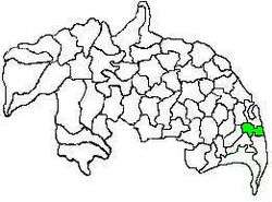 Mandal map of Guntur district showing Bhattiprolu mandal (in green) | |
 Bhattiprolu mandal Location in Andhra Pradesh, India | |
| Coordinates: 16°06′09″N 80°46′51″E / 16.1026°N 80.7807°ECoordinates: 16°06′09″N 80°46′51″E / 16.1026°N 80.7807°E | |
| Country | India |
| State | Andhra Pradesh |
| District | Guntur |
| Headquarters | Bhattiprolu |
| Government | |
| • Body | Mandal Parishad |
| • Tahsildar | KALVA LAKSHMI PRASAD |
| Area[1] | |
| • Total | 112.92 km2 (43.60 sq mi) |
| Population (2011) | |
| • Total | 50,252 |
| • Density | 450/km2 (1,200/sq mi) |
| Languages | |
| • Official | Telugu |
| Time zone | UTC+5:30 (IST) |
Bhattiprolu mandal is one of the 57 mandals in Guntur district of the Indian state of Andhra Pradesh. It is under the administration of Tenali revenue division and the headquarters are located at Bhattiprolu.[2][3] The mandal is situated on the banks of Krishna River, bounded by Kollur, Vemuru, Cherukupalle, Nagaram and Repalle mandals.[4] The mandal headquarters ten villages are included in Andhra Pradesh Capital Region.[5][6]
Demographics
As of 2011 census, the mandal had a population of 50,252. The total population constitute, 25,134 males and 25,118 females —a sex ratio of 999 females per 1000 males. 4,344 children are in the age group of 0–6 years, of which 2,281 are boys and 2,063 are girls. The average literacy rate stands at 70.65% with 32,436 literates.[1]
Governance
The mandal is partially a part of the Andhra Pradesh Capital Region under the jurisdiction of APCRDA.[7] It is under the control of a tahsildar and the present tahsildar is D.V.Subba Rao.[8]
Bhattiprolu mandal is one of the 5 mandals under Vemuru (SC) (Assembly constituency), which in turn represents Bapatla (SC) (Lok Sabha constituency) of Andhra Pradesh.[9]
Towns and villages
As of 2011 census, the mandal has #12 villages and no towns.[2][10]
The settlements in the mandal are listed below:
- Addepalli
- Akkivaripalem
- Bhattiprolu †
- Guthavaripalem
- Gorigapudi
- Jiluguvaripalem
- Konetipuram
- Oleru
- Pallekona
- Pedalanka
- Pedapulivarru
- Pesarlanka
- Sivangulapalem
- Surepalle
- Vellaturu
Note:†–Mandal headquarter
Education
The mandal plays a major role in education for the rural students of the nearby villages.The primary and secondary school education is imparted by government, aided and private schools, under the School Education Department of the state.[11] As per the school information report for the academic year 2015–16, the mandal has more than 6,040 students enrolled in over 66 schools.[12][13]
See also
References
- 1 2 "District Census Handbook - Guntur" (PDF). Census of India. p. 14,474. Retrieved 21 February 2016.
- 1 2 "Guntur District Mandals" (PDF). Census of India. pp. 98, 111. Retrieved 21 February 2016.
- ↑ "Adminsistrative divisions of Guntur district" (PDF). guntur.nic.in. Retrieved 21 February 2016.
- ↑ "Mandals in Guntur district". aponline.gov.in. Archived from the original on 28 April 2015. Retrieved 21 February 2016.
- ↑ "District wise mandals and villages covered in Krishna and Guntur districts" (PDF). Andhra Pradesh Capital Region Development Authority. Government of Andhra Pradesh. Archived from the original (PDF) on 23 September 2015. Retrieved 23 September 2015.
- ↑ "Declaration of A.P. Capital Region" (PDF). Andhra Nation. Municipal Administration and Urban Development Department. 22 September 2015. Archived from the original (PDF) on 21 February 2016. Retrieved 21 February 2016.
- ↑ "Declaration of A.P. CapitalRegion" (PDF). APCRDA. Municipal Administration and UrbanDevelopmentDepartment. 22 September 2015. Archived from the original (PDF) on 23 September 2015. Retrieved 21 February 2016.
- ↑ "List of Tahsildars working in Guntur District as on 19.06.2014" (PDF). Guntur District Official Website. National Informatics Centre. p. 5. Retrieved 21 February 2016.
- ↑ "Delimitation of Parliamentary and Assembly Constituencies Order, 2008" (pdf). Election Commission of India. pp. 22, 31. Retrieved 21 February 2016.
- ↑ "Sub-District Details of Guntur District". The Registrar General & Census Commissioner, India. Retrieved 8 August 2014.
- ↑ "School Education Department" (PDF). School Education Department, Government of Andhra Pradesh. Archived from the original (PDF) on 27 December 2015. Retrieved 7 November 2016.
- ↑ "R1.1 SCHOOL INFORMATION". Archived from the original on 2016-11-08.
- ↑ "R3.1 STUDENT INFORMATION".