Szécsény District
| Szécsény District Szécsényi járás | ||
|---|---|---|
| Districts of Hungary | ||
| ||
 Szécsény District within Hungary and Nógrád County. | ||
| Country |
| |
| County | Nógrád | |
| District seat | Szécsény | |
| Area | ||
| • Total | 285.26 km2 (110.14 sq mi) | |
| Area rank | 5th in Nógrád | |
| Population (2011 census) | ||
| • Total | 19,587 | |
| • Rank | 6th in Nógrád | |
| • Density | 69/km2 (180/sq mi) | |

Szécsény (Hungarian: Szécsényi járás) is a district in northern part of Nógrád County. Szécsény is also the name of the town where the district seat is found. The district is located in the Northern Hungary Statistical Region.
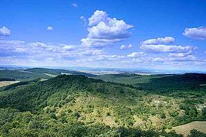
Geography
Szécsény District borders with the Slovakian region of Banská Bystrica to the north and west, Salgótarján District to the northeast, Pásztó District to the south, Balassagyarmat District to the southwest. The number of the inhabited places in Szécsény District is 14.
Municipalities
The district has 1 town and 13 villages. (ordered by population, as of 1 January 2013)[1]
- Endrefalva (1,238)
- Hollókő (329)
- Ludányhalászi (1,496)
- Magyargéc (899)
- Nagylóc (1,591)
- Nógrádmegyer (1,716)
- Nógrádsipek (698)
- Nógrádszakál (636)
- Piliny (589)
- Rimóc (1,841)
- Szalmatercs (441)
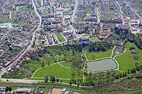
- Szécsény (5,999) – district seat
- Szécsényfelfalu (418)
- Varsány (1,646)
The bolded municipality is city.
Demographics
Religion in Szécsény District (2011 census)
In 2011, it had a population of 19,587 and the population density was 69/km².
| Year | County population[2] | Change |
|---|---|---|
| 2011 | 19,587 | n/a |
Ethnicity
Besides the Hungarian majority, the main minority is the Roma (approx. 3,000).
Total population (2011 census): 19,587
Ethnic groups (2011 census):[3] Identified themselves: 20,415 persons:
- Hungarians: 17,548 (85.96%)
- Gypsies: 2,686 (13.16%)
- Others and indefinable: 181 (0.89%)
Approx. 1,000 persons in Szécsény District did declare more than one ethnic group at the 2011 census.
Religion
Religious adherence in the county according to 2011 census:[4]
- Catholic – 14,152 (Roman Catholic – 14,134; Greek Catholic – 17);
- Evangelical – 163;
- Reformed – 146;
- other religions – 339;
- Non-religious – 1,044;
- Atheism – 56;
- Undeclared – 3,687.
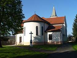
Gallery
.jpg)
See also
References
- ↑ A KSH 2013. évi helységnévkönyve
- ↑ népesség.com, "Szécsényi járás népessége"
- ↑ 4.1.6.1 A népesség nemzetiség szerint, 2011, (in Hungarian)
- ↑ 4.1.7.1 A népesség vallás, felekezet szerint, 2011, (in Hungarian)
External links
| Town (1) |
| |
|---|---|---|
| Villages (13) | ||