BNI City railway station
Coordinates: 6°12′07″S 106°49′15″E / 6.201917°S 106.820913°E
BNI City railway station Stasiun BNI City | ||||||||||||||||||||||||||||||||||||||||||||||||||||||||||||||||||||||||||||||||||||||||||||||||||||||||||||||||||||||||||||||||||||||||||||
|---|---|---|---|---|---|---|---|---|---|---|---|---|---|---|---|---|---|---|---|---|---|---|---|---|---|---|---|---|---|---|---|---|---|---|---|---|---|---|---|---|---|---|---|---|---|---|---|---|---|---|---|---|---|---|---|---|---|---|---|---|---|---|---|---|---|---|---|---|---|---|---|---|---|---|---|---|---|---|---|---|---|---|---|---|---|---|---|---|---|---|---|---|---|---|---|---|---|---|---|---|---|---|---|---|---|---|---|---|---|---|---|---|---|---|---|---|---|---|---|---|---|---|---|---|---|---|---|---|---|---|---|---|---|---|---|---|---|---|---|---|
| Location | Jakarta, Indonesia | |||||||||||||||||||||||||||||||||||||||||||||||||||||||||||||||||||||||||||||||||||||||||||||||||||||||||||||||||||||||||||||||||||||||||||
| Coordinates | 6°12′07″S 106°49′15″E / 6.201917°S 106.820913°E | |||||||||||||||||||||||||||||||||||||||||||||||||||||||||||||||||||||||||||||||||||||||||||||||||||||||||||||||||||||||||||||||||||||||||||
| Owned by | Indonesian Railway Company | |||||||||||||||||||||||||||||||||||||||||||||||||||||||||||||||||||||||||||||||||||||||||||||||||||||||||||||||||||||||||||||||||||||||||||
| Operated by | Railink | |||||||||||||||||||||||||||||||||||||||||||||||||||||||||||||||||||||||||||||||||||||||||||||||||||||||||||||||||||||||||||||||||||||||||||
| Line(s) | Soekarno-Hatta ARS | |||||||||||||||||||||||||||||||||||||||||||||||||||||||||||||||||||||||||||||||||||||||||||||||||||||||||||||||||||||||||||||||||||||||||||
| Platforms | 2 side platforms | |||||||||||||||||||||||||||||||||||||||||||||||||||||||||||||||||||||||||||||||||||||||||||||||||||||||||||||||||||||||||||||||||||||||||||
| Tracks | 2 | |||||||||||||||||||||||||||||||||||||||||||||||||||||||||||||||||||||||||||||||||||||||||||||||||||||||||||||||||||||||||||||||||||||||||||
| Construction | ||||||||||||||||||||||||||||||||||||||||||||||||||||||||||||||||||||||||||||||||||||||||||||||||||||||||||||||||||||||||||||||||||||||||||||
| Parking | Available | |||||||||||||||||||||||||||||||||||||||||||||||||||||||||||||||||||||||||||||||||||||||||||||||||||||||||||||||||||||||||||||||||||||||||||
| Disabled access | Available | |||||||||||||||||||||||||||||||||||||||||||||||||||||||||||||||||||||||||||||||||||||||||||||||||||||||||||||||||||||||||||||||||||||||||||
| History | ||||||||||||||||||||||||||||||||||||||||||||||||||||||||||||||||||||||||||||||||||||||||||||||||||||||||||||||||||||||||||||||||||||||||||||
| Opened | 26 December 2017[1] | |||||||||||||||||||||||||||||||||||||||||||||||||||||||||||||||||||||||||||||||||||||||||||||||||||||||||||||||||||||||||||||||||||||||||||
| Services | ||||||||||||||||||||||||||||||||||||||||||||||||||||||||||||||||||||||||||||||||||||||||||||||||||||||||||||||||||||||||||||||||||||||||||||
| ||||||||||||||||||||||||||||||||||||||||||||||||||||||||||||||||||||||||||||||||||||||||||||||||||||||||||||||||||||||||||||||||||||||||||||
| ||||||||||||||||||||||||||||||||||||||||||||||||||||||||||||||||||||||||||||||||||||||||||||||||||||||||||||||||||||||||||||||||||||||||||||
| Location | ||||||||||||||||||||||||||||||||||||||||||||||||||||||||||||||||||||||||||||||||||||||||||||||||||||||||||||||||||||||||||||||||||||||||||||
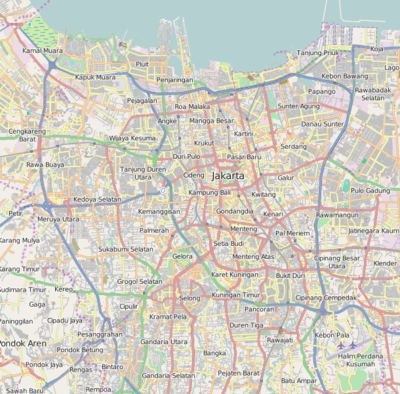 BNI City railway station Location within Jakarta | ||||||||||||||||||||||||||||||||||||||||||||||||||||||||||||||||||||||||||||||||||||||||||||||||||||||||||||||||||||||||||||||||||||||||||||
BNI City railway station (Indonesian: Stasiun BNI City) (Bank Negara Indonesia granted for naming rights)[2] is a station for the Soekarno-Hatta Airport Rail Link service. The station was known as Sudirman Baru railway station during construction period. The station is located in Central Jakarta,[3] on the north bank of West Flood Canal, about a hundred meters from Sudirman Commuter Rail station.
Sudirman Baru Station has three floors and is about 500 metres (1,600 feet) in length. On the ground floor, a number of station support facilities such as escalators, tap-in and tap-out machines, ticket vending machines, two seating areas for passengers, and lifts are located. There are also food outlets, minimarkets, toilets, mosques, clinics, and self-service flight check-in machines.
The upstairs of the station will also be used for platform, which is 240 metres (790 feet) long and 32 metres (105 feet) wide. There are four escalators in the station. The station has a parking lot.[4]
Naming rights
The station is named as BNI City (Indonesian: Stasiun BNI City), after its naming rights was purchased by Bank Negara Indonesia.[5] It is the first railway station in Indonesia which granted its naming rights to a corporation. [6] The station is located on the north bank of the West Flood Canal, about hundred meters away from Sudirman station of Jakarta Commuter service.
Other public transportation
TransJakarta operates feeder routes from the station to Gatot Subroto Avenue, Pacific Place and Gambir station with a fare of Rp 3,500 (about 25 US cents).
The feeder route from BNI City station to Gambir station is incorporated with Corridor 1 of TransJakarta. The route is BNI City-Hotel Indonesia-Sarinah-Bank Indonesia-Patung Kuda-Gambir Station-Merdeka Palace-Monas-then back to Bank Indonesia-Sarinah-Hotel Indonesia-Blora-BNI City.
Another available route passes through Menteng and is integrated with Corridor 9. The route is BNI City-Hotel Indonesia- Tosari-Dukuh Atas-Karet-Semanggi-Kuningan-Menteng-Hotel Indonesia-Blora-BNI City.[7][8] The station can also be reached by Corridor 1, 4 and 6.
The station will also be integrated with Jakarta LRT and Jakarta MRT.
See also
References
- ↑ "Jakarta airport rail link opens, proves a hit with travellers". Straits Times. 31 December 2017. Retrieved 11 March 2018.
- ↑ "BNI Peroleh Hak Penggunaan Nama Stasiun BNI City". infobanknews.com (in Indonesian). Retrieved 2 January 2018.
- ↑ "Menanti Operasionalisasi Stasiun Sudirman Baru dan Kereta Bandara". Kompas (in Indonesian). Retrieved 1 December 2017.
- ↑ "Akan Dilintasi Kereta Bandara, Begini Penampakan Stasiun Sudirman Baru". Kompas (in Indonesian). Retrieved 1 December 2017.
- ↑ "BNI Peroleh Hak Penggunaan Nama Stasiun BNI City". infobanknews.com. Retrieved 28 February 2018.
- ↑ "Menanti Operasionalisasi Stasiun Sudirman Baru dan Kereta Bandara". Kompas (in Indonesian). Retrieved 1 December 2017.
- ↑ "15 feeder buses ready to serve new airport train passengers". The Jakarta Post. Retrieved 28 December 2017.
- ↑ "Menuju Stasiun Sudirman Baru Bisa Naik Transjakarta, Ini Rutenya". Kompas (in Indonesian). Retrieved 28 December 2017.