Stumpy Point, North Carolina
| Stumpy Point, North Carolina | |
|---|---|
| Unincorporated community | |
 Stumpy Point Location within the state of North Carolina | |
| Coordinates: 35°41′54″N 75°44′27″W / 35.69833°N 75.74083°WCoordinates: 35°41′54″N 75°44′27″W / 35.69833°N 75.74083°W | |
| Country | United States |
| State | North Carolina |
| County | Dare County |
| Elevation | 3 ft (0.9144 m) |
| Time zone | UTC-5 (Eastern (EST)) |
| • Summer (DST) | UTC-4 (EDT) |
| ZIP code | 27978 |
| Area code(s) | 252 |
Stumpy Point is an unincorporated community in Dare County, North Carolina, United States.[1] The community is located at the intersection of US 264 and Bayview Drive; along the north side of Stumpy Point Bay. It is surrounded by the Alligator River National Wildlife Refuge.
A post office called Stumpy Point has been in operation since 1876.[2] The community takes its name from Stumpy Point Bay.[3]
The North Carolina Ferry System maintains an emergency ferry terminal at Stumpy Point, used when a hurricane or tropical storm closes North Carolina Highway 12 on the Outer Banks.
The town is mentioned in the sci-fi novel Ender's Game by Orson Scott Card, in which the little town is razed sometime in the future to build a spaceport in Pamlico Sound, and the spaceport is unofficially named after Stumpy Point.
References
- ↑ "Stumpy Point". Geographic Names Information System. United States Geological Survey.
- ↑ "Post Offices". Jim Forte Postal History. Retrieved 5 January 2017.
- ↑ Moyer, Armond; Moyer, Winifred (1958). The origins of unusual place-names. Keystone Pub. Associates. p. 127.
Municipalities and communities of Dare County, North Carolina, United States | ||
|---|---|---|
| Towns | 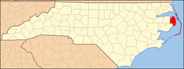 | |
| CDPs | ||
| Unincorporated communities | ||