Stockhausen-Illfurth
| Stockhausen-Illfurth | |
|---|---|
 Stockhausen-Illfurth Location of Stockhausen-Illfurth within Westerwaldkreis district 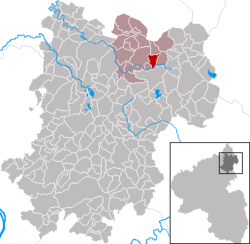 | |
| Coordinates: 50°38′48″N 7°59′15″E / 50.64667°N 7.98750°ECoordinates: 50°38′48″N 7°59′15″E / 50.64667°N 7.98750°E | |
| Country | Germany |
| State | Rhineland-Palatinate |
| District | Westerwaldkreis |
| Municipal assoc. | Bad Marienberg (Westerwald) |
| Government | |
| • Mayor | Karl-Heinz Baldus |
| Area | |
| • Total | 3.24 km2 (1.25 sq mi) |
| Elevation | 496 m (1,627 ft) |
| Population (2017-12-31)[1] | |
| • Total | 464 |
| • Density | 140/km2 (370/sq mi) |
| Time zone | CET/CEST (UTC+1/+2) |
| Postal codes | 56472 |
| Dialling codes | 02661 |
| Vehicle registration | WW |
| Website | www.bad-marienberg.de |
Stockhausen-Illfurth is an Ortsgemeinde – a community belonging to a Verbandsgemeinde – in the Westerwaldkreis in Rhineland-Palatinate, Germany.
Geography
Location
The community lies in the Westerwald between Limburg und Siegen. Through the community flows the Große Nister. Stockhausen-Illfurth belongs to the Verbandsgemeinde of Bad Marienberg, a kind of collective municipality. Its seat is in the like-named town.
History
In 1438, Stockhausen-Illfurth had its first documentary mention.
Politics
Community council
The council is made up of 8 council members who were elected in a majority vote in a municipal election on 13 June 2004.
Economy and infrastructure
Transport
North of the community runs Bundesstraße 414, leading from Hohenroth to Hachenburg. The nearest Autobahn interchange is Haiger/Burbach on the A 45 (Dortmund–Hanau), some 22 km away. The nearest InterCityExpress stop is the railway station at Montabaur on the Cologne-Frankfurt high-speed rail line.
References
- ↑ Statistisches Landesamt Rheinland-Pfalz "Bevölkerungsstand 2017 - Gemeindeebene" Check
|url=value (help). Statistisches Landesamt Rheinland-Pfalz (in German). 2018.
External links
| Authority control |
|---|