Linden, Westerwaldkreis
| Linden | ||
|---|---|---|
| ||
 Linden Location of Linden within Westerwaldkreis district 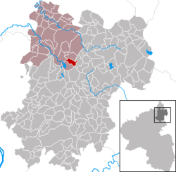 | ||
| Coordinates: 50°36′12″N 7°51′5″E / 50.60333°N 7.85139°ECoordinates: 50°36′12″N 7°51′5″E / 50.60333°N 7.85139°E | ||
| Country | Germany | |
| State | Rhineland-Palatinate | |
| District | Westerwaldkreis | |
| Municipal assoc. | Hachenburg | |
| Government | ||
| • Mayor | Wilfried Baesener | |
| Area | ||
| • Total | 2.51 km2 (0.97 sq mi) | |
| Elevation | 464 m (1,522 ft) | |
| Population (2017-12-31)[1] | ||
| • Total | 157 | |
| • Density | 63/km2 (160/sq mi) | |
| Time zone | CET/CEST (UTC+1/+2) | |
| Postal codes | 57629 | |
| Dialling codes | 02666 | |
| Vehicle registration | WW | |
| Website | www.linden-ww.de | |
.jpg)
Linden is an Ortsgemeinde – a community belonging to a Verbandsgemeinde – in the Westerwaldkreis in Rhineland-Palatinate, Germany.
Geography
Location
The village of Linden lies north-northeast of Koblenz between Hachenburg in the north-northwest and Westerburg in the southeast, not far northeast of the Westerwald Lake Plateau. The community’s highest point is the Wildenhahn (496 m above sea level), which lies roughly 650 m northwest of Linden. Directly north of the village is found the source of the river Wied (an eastern tributary to the Rhine), which passes Linden just to the east, flowing south towards the Dreifelder Weiher (lake).
Linden belongs to the Verbandsgemeinde of Hachenburg, a kind of collective municipality. Its seat is in the like-named town.
History
Like many communities in the Westerwald, Linden first arose as a clearing for field cultivation. Although it had its first documentary mention in 1586, it is believed that Linden already existed by about 1315.
Politics
Community council
The council is made up of 7 council members, including the extraofficial mayor (Bürgermeister), who were elected in a majority vote in a municipal election on 13 June 2004.
Economy and infrastructure
Of the once 21-strong agricultural businesses, none is now left. The community’s livelihood is nowadays drawn from tourism, service industries and small industry.
Transport
Linden is connected to the national highway network by Bundesstraße 8, which links the community to the middle centres of Hachenburg (10 km) and Altenkirchen (6 km). The Autobahn interchanges Mogendorf and Dierdorf on the A 3 (Cologne–Frankfurt) can be reached by way of Bundesstraßen 8 and 413, while the Hennef interchange on the A 5 (AS 60) can be reached by way of Bundesstraße 8.
References
- ↑ Statistisches Landesamt Rheinland-Pfalz "Bevölkerungsstand 2017 - Gemeindeebene" Check
|url=value (help). Statistisches Landesamt Rheinland-Pfalz (in German). 2018.
External links
- Linden (in German)
- Linden in the collective municipality’s Web pages (in German)