Niederahr
| Niederahr | ||
|---|---|---|
| ||
 Niederahr Location of Niederahr within Westerwaldkreis district 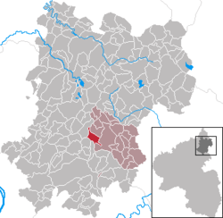 | ||
| Coordinates: 50°29′31″N 7°51′40″E / 50.49194°N 7.86111°ECoordinates: 50°29′31″N 7°51′40″E / 50.49194°N 7.86111°E | ||
| Country | Germany | |
| State | Rhineland-Palatinate | |
| District | Westerwaldkreis | |
| Municipal assoc. | Wallmerod | |
| Government | ||
| • Mayor | Hermann Girhard | |
| Area | ||
| • Total | 4.03 km2 (1.56 sq mi) | |
| Elevation | 300 m (1,000 ft) | |
| Population (2017-12-31)[1] | ||
| • Total | 811 | |
| • Density | 200/km2 (520/sq mi) | |
| Time zone | CET/CEST (UTC+1/+2) | |
| Postal codes | 56414 | |
| Dialling codes | 02602 | |
| Vehicle registration | WW | |
| Website | www.wallmerod.de | |

Niederahr is an Ortsgemeinde – a community belonging to a Verbandsgemeinde – in the Westerwaldkreis in Rhineland-Palatinate, Germany.
Geography
Location
The community lies in the Westerwald between Montabaur and Hachenburg. Through the community flows the Ahrbach. The community belongs to the Verbandsgemeinde of Wallmerod, a kind of collective municipality. Its seat is in the like-named town.
History
In 959, Niederahr had its first documentary mention.
Politics
Community council
The council is made up of 12 council members who were elected in a majority vote in a municipal election on 13 June 2004.
Economy and infrastructure
Transport
Right through the community runs Bundesstraße 255, linking Montabaur and Rennerod. The nearest Autobahn interchange is Montabaur on the A 3 (Cologne–Frankfurt), some 5 km away. The nearest InterCityExpress stop is the railway station at Montabaur on the Cologne-Frankfurt high-speed rail line.
Established businesses
Westfalia Separator makes decanters at its Niederahr works.
References
- ↑ Statistisches Landesamt Rheinland-Pfalz "Bevölkerungsstand 2017 - Gemeindeebene" Check
|url=value (help). Statistisches Landesamt Rheinland-Pfalz (in German). 2018.
External links
- Niederahr (in German)