Berod bei Wallmerod
| Berod bei Wallmerod | ||
|---|---|---|
| ||
 Berod bei Wallmerod Location of Berod bei Wallmerod within Westerwaldkreis district 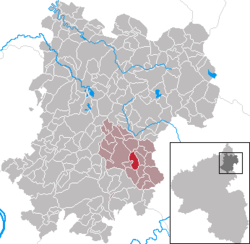 | ||
| Coordinates: 50°28′54″N 7°56′10″E / 50.48167°N 7.93611°ECoordinates: 50°28′54″N 7°56′10″E / 50.48167°N 7.93611°E | ||
| Country | Germany | |
| State | Rhineland-Palatinate | |
| District | Westerwaldkreis | |
| Municipal assoc. | Wallmerod | |
| Government | ||
| • Mayor | Berthold Schönberg | |
| Area | ||
| • Total | 3.92 km2 (1.51 sq mi) | |
| Elevation | 300 m (1,000 ft) | |
| Population (2017-12-31)[1] | ||
| • Total | 550 | |
| • Density | 140/km2 (360/sq mi) | |
| Time zone | CET/CEST (UTC+1/+2) | |
| Postal codes | 56414 | |
| Dialling codes | 06435 | |
| Vehicle registration | WW | |
| Website | www.wallmerod.de | |

Berod bei Wallmerod is an Ortsgemeinde – a community belonging to a Verbandsgemeinde – in the Westerwaldkreis in Rhineland-Palatinate, Germany.
Geography
Location
The community lies in the Westerwald between Montabaur and Wetzlar. Through the community from north to south flows the Eisenbach. The community belongs to the Verbandsgemeinde of Wallmerod, a kind of collective municipality.
History
In 1292, Berod had its first documentary mention as Berrinrode.
Politics
Community council
The council is made up of 12 council members who were elected in a majority vote in a municipal election on 7 June 2009.
Economy and infrastructure
Transport
Right near the community runs Bundesstraße 8 linking Altenkirchen (Westerwald) and Limburg an der Lahn. The nearest Autobahn interchange is Diez on the A 3 (Cologne–Frankfurt am Main), some 10 km away. The nearest InterCityExpress stop is at the railway station at Montabaur on the Cologne-Frankfurt high-speed rail line.
References
- ↑ Statistisches Landesamt Rheinland-Pfalz "Bevölkerungsstand 2017 - Gemeindeebene" Check
|url=value (help). Statistisches Landesamt Rheinland-Pfalz (in German). 2018.
External links
| Authority control |
|---|