Marzhausen
| Marzhausen | ||
|---|---|---|
| ||
 Marzhausen Location of Marzhausen within Westerwaldkreis district 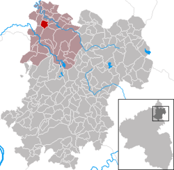 | ||
| Coordinates: 50°41′28″N 7°45′21″E / 50.69111°N 7.75583°ECoordinates: 50°41′28″N 7°45′21″E / 50.69111°N 7.75583°E | ||
| Country | Germany | |
| State | Rhineland-Palatinate | |
| District | Westerwaldkreis | |
| Municipal assoc. | Hachenburg | |
| Government | ||
| • Mayor | Gregor Brings | |
| Area | ||
| • Total | 3.03 km2 (1.17 sq mi) | |
| Elevation | 300 m (1,000 ft) | |
| Population (2017-12-31)[1] | ||
| • Total | 238 | |
| • Density | 79/km2 (200/sq mi) | |
| Time zone | CET/CEST (UTC+1/+2) | |
| Postal codes | 57627 | |
| Dialling codes | 02688 | |
| Vehicle registration | WW | |
| Website | www.hachenburg-vg.de | |

Marzhausen is an Ortsgemeinde – a community belonging to a Verbandsgemeinde – in the Westerwaldkreis in Rhineland-Palatinate, Germany. The community, first documented in 1346, lies between Hachenburg and Altenkirchen on the edge of the Kroppach Switzerland (Kroppacher Schweiz) and is characterized by agriculture. Marzhausen belongs to the Verbandsgemeinde of Hachenburg, a kind of collective municipality, governed by a community council of 7 council members, including the extraofficial mayor (Bürgermeister), who are elected.
Marzhausen is linked to the long-distance highway network through Bundesstraße 414. The Autobahn interchanges Mogendorf and Dierdorf on the A 3 (Cologne–Frankfurt) can me reached over Bundesstraßen 8 and 413.
References
- ↑ Statistisches Landesamt Rheinland-Pfalz "Bevölkerungsstand 2017 - Gemeindeebene" Check
|url=value (help). Statistisches Landesamt Rheinland-Pfalz (in German). 2018.
External links
This article is issued from
Wikipedia.
The text is licensed under Creative Commons - Attribution - Sharealike.
Additional terms may apply for the media files.