Borough of Stafford
| Borough of Stafford | |
|---|---|
| Non-metropolitan district | |
 Stafford shown within Staffordshire | |
| Sovereign state | United Kingdom |
| Constituent country | England |
| Region | West Midlands |
| Non-metropolitan county | Staffordshire |
| Status | Non-metropolitan district |
| Admin HQ | Stafford |
| Incorporated | 1 April 1974 |
| Government | |
| • Type | Non-metropolitan district council |
| • Body | Stafford Borough Council |
| • Leadership | Leader & Cabinet (Conservative) |
| • MPs |
William Cash Jeremy Lefroy |
| Area | |
| • Total | 231.0 sq mi (598.2 km2) |
| Area rank | 71st (of 326) |
| Population (mid-2017 est.) | |
| • Total | 134,800 |
| • Rank | 162nd (of 326) |
| • Density | 580/sq mi (230/km2) |
| • Ethnicity |
97.4% White 1.0% S.Asian |
| Time zone | UTC0 (GMT) |
| • Summer (DST) | UTC+1 (BST) |
| ONS code |
41UG (ONS) E07000197 (GSS) |
| OS grid reference | SJ9213623094 |
| Website |
www |
The Borough of Stafford is a local government district with borough status in Staffordshire in England. It is named after and includes the town of Stafford. It also includes the smaller town of Stone and numerous villages.
The borough was formed on 1 April 1974, under the Local Government Act 1972, as a merger of the municipal borough of Stafford, Stone urban district, Stafford Rural District and Stone Rural District.
Most its parishes fell within the Hundred of Pirehill.
Wards
It has 26 wards: Barlaston and Oulton, Baswich, Chartley, Church Eaton, Common, Coton, Eccleshall, Forebridge, Fulford, Gnosall and Woodseaves, Haywood and Hixon, Highfield and Western Downs, Holmcroft, Littleworth, Manor, Milford, Milwich, Penkside, Rowley, Seighford, St. Michael's, Stonefield and Christchurch, Swynnerton, Tillington, Walton and Weeping Cross. [1]
Settlements and parishes of Stafford
| Settlement | Borough Ward | Parish |
|---|---|---|
| Adbaston | Eccleshall | Adbaston |
| Barlaston | Barlaston and Oulton | Barlaston |
| Berkswich | Milford | Berkswich |
| Bradley | Church Eaton | Bradley |
| Brocton | Milford | Brocton |
| Chebsey | Eccleshall | Chebsey |
| Church Eaton | Church Eaton | Church Eaton |
| Colwich | Haywood and Hixon | Colwich |
| Creswell | Seighford | Creswell |
| Eccleshall | Eccleshall | Eccleshall |
| Ellenhall | Seighford | Ellenhall |
| Forton | Gnosall and Woodseaves | |
| Fradswell | Milwich | |
| Fulford | Fulford | Fulford |
| Gayton | Chartley | |
| Gnosall | Gnosall and Woodseaves | Gnosall |
| Haughton | Church Eaton | Haughton |
| High Offley | Gnosall and Woodseaves | |
| Hixon | Haywood and Hixon | |
| Hilderstone | Milwich | Hilderstone |
| Hopton and Coton | Coton | |
| Hyde Lea | Seighford | Hyde Lea |
| Ingestre | Milford | |
| Knightley | Gnosall and Woodseaves | |
| Marston | Seighford | |
| Milwich | Milwich | |
| Norbury | Gnosall and Woodseaves | |
| Ranton | Seighford | |
| Salt and Enson | Chartley | |
| Sandon and Burston | Walton | |
| Seighford | Seighford | |
| Standon | Eccleshall | |
| Stone | Stonefield and Christchurch | |
| Stone Rural | Milwich | |
| Stowe-by-Chartley | Chartley | |
| Swynnerton | Swynnerton | Swynnerton |
| Tixall | Milford | |
| Weston | Chartley | |
| Whitgreave | Seighford | |
| Woodseaves | Gnosall and Woodseaves |
References
- ↑ "List of wards". Stafford Borough Council.
| Unitary authorities | |
|---|---|
| Boroughs or districts | |
| Major settlements | |
| Rivers | |
| Canals | |
| Topics | |
Districts of the West Midlands Region | ||
|---|---|---|
| Herefordshire | 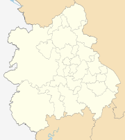 | |
| Shropshire | ||
| Staffordshire | ||
| Warwickshire | ||
| West Midlands | ||
| Worcestershire | ||
Coordinates: 52°48′18.05″N 2°6′59.99″W / 52.8050139°N 2.1166639°W