Englefield, Berkshire
| Englefield | |
|---|---|
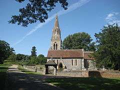 St Mark's Church | |
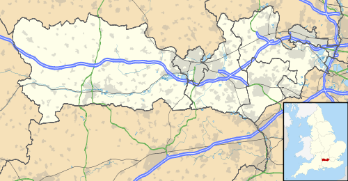 Englefield Englefield shown within Berkshire | |
| Area | 9.25 km2 (3.57 sq mi) |
| Population | 286 (2011 census)[1] |
| • Density | 31/km2 (80/sq mi) |
| OS grid reference | SU6272 |
| Civil parish |
|
| Unitary authority | |
| Ceremonial county | |
| Region | |
| Country | England |
| Sovereign state | United Kingdom |
| Post town | READING |
| Postcode district | RG7 |
| Police | Thames Valley |
| Fire | Royal Berkshire |
| Ambulance | South Central |
| EU Parliament | South East England |
| UK Parliament | |
Englefield is a village and civil parish in the English county of Berkshire. The village is mostly within the bounds of the private walled estate of Englefield House. The village is in the district of West Berkshire, close to Reading.
Battle of Englefield
In 870, the village was the site of the Battle of Englefield. This was fought between the Anglo-Saxons, under Æthelwulf, Ealdorman of Berkshire, and the Danes, and resulted in a resounding victory for the Saxons. The battle was the first of a series in the winter of 870-1. The village may have been named after the battle, Englefield meaning "English field".
The place-name 'Englefield' is first attested in the Anglo Saxon Chronicle for 871, where it appears as Engla feld. It appears as Englefel in the Domesday Book of 1086, and as Englefeld in the Feet of Fines for 1196. The name indicates settlement by the Angles in Saxon territory.[2]
Englefield House
Englefield House was the home of the Englefield family, supposedly from the time of King Edgar and certainly until the Elizabethan era when the present building was erected. The house eventually passed to the Benyon family.
Village
In the late 19th century, Richard Fellowes Benyon rebuilt the villagers' houses as a model estate village and provided them with such amenities as a swimming pool, soup kitchen and a new school. Today the estate, owned by a family company, the Englefield Estate, covers some 20,000 acres (8,100 ha), and its farm is a beneficiary of European Union agricultural subsidies.[3] The village relies on and contributes to the amenities and organisations in Theale and Tilehurst as well as Reading which bound it to the south and east.
Demography
| Output area | Homes owned outright | Owned with a loan | Socially rented | Privately rented | Other | km² roads | km² water | km² domestic gardens | Usual residents | km² |
|---|---|---|---|---|---|---|---|---|---|---|
| Civil parish | 14 | 8 | 9 | 65 | 28 | 0.147 | 0.109 | 0.124 | 286 | 9.25 |
References
- 1 2 Key Statistics: Dwellings; Quick Statistics: Population Density; Physical Environment: Land Use Survey 2005
- ↑ Eilert Ekwall, The Concise Oxford Dictionary of English Place-names, p.167.
- ↑ Robert Verkaik (27 February 2011). "Wealthy minister earns £2m subsidies in EU farm subsidies which his department tried to cover up". Daily Mail. Retrieved 27 February 2011.
External links
![]()