St. Paul, Iowa
| St. Paul, Iowa | |
|---|---|
| City | |
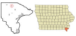 Location of St. Paul, Iowa | |
| Coordinates: 40°46′1″N 91°31′1″W / 40.76694°N 91.51694°WCoordinates: 40°46′1″N 91°31′1″W / 40.76694°N 91.51694°W | |
| Country |
|
| State |
|
| County | Lee |
| Area[1] | |
| • Total | 0.38 sq mi (0.98 km2) |
| • Land | 0.38 sq mi (0.98 km2) |
| • Water | 0 sq mi (0 km2) |
| Elevation | 712 ft (217 m) |
| Population (2010)[2] | |
| • Total | 129 |
| • Estimate (2016)[3] | 131 |
| • Density | 340/sq mi (131.1/km2) |
| Time zone | UTC-6 (Central (CST)) |
| • Summer (DST) | UTC-5 (CDT) |
| FIPS code | 19-70185 |
| GNIS feature ID | 0461270 |
St. Paul is a city in Lee County, Iowa, United States. The population was 129 at the 2010 census. It is part of the Fort Madison–Keokuk, IA-MO Micropolitan Statistical Area.
History
St. Paul was laid out in 1866.[4]
Geography
St. Paul is located at 40°46′1″N 91°31′1″W / 40.76694°N 91.51694°W (40.766957, -91.516955).[5]
According to the United States Census Bureau, the city has a total area of 0.38 square miles (0.98 km2), all of it land.[1]
Demographics
| Historical populations | ||
|---|---|---|
| Year | Pop. | ±% |
| 1880 | 37 | — |
| 1900 | 65 | +75.7% |
| 1910 | 62 | −4.6% |
| 1920 | 67 | +8.1% |
| 1930 | 89 | +32.8% |
| 1940 | 94 | +5.6% |
| 1950 | 113 | +20.2% |
| 1960 | 128 | +13.3% |
| 1970 | 129 | +0.8% |
| 1980 | 141 | +9.3% |
| 1990 | 120 | −14.9% |
| 2000 | 118 | −1.7% |
| 2010 | 129 | +9.3% |
| 2016 | 131 | +1.6% |
| Source:"American FactFinder". United States Census Bureau.
and Iowa Data Center Source: | ||
2010 census
As of the census[2] of 2010, there were 129 people, 52 households, and 36 families residing in the city. The population density was 339.5 inhabitants per square mile (131.1/km2). There were 53 housing units at an average density of 139.5 per square mile (53.9/km2). The racial makeup of the city was 98.4% White, 0.8% Asian, and 0.8% from two or more races.
There were 52 households of which 21.2% had children under the age of 18 living with them, 57.7% were married couples living together, 9.6% had a female householder with no husband present, 1.9% had a male householder with no wife present, and 30.8% were non-families. 28.8% of all households were made up of individuals and 5.8% had someone living alone who was 65 years of age or older. The average household size was 2.48 and the average family size was 3.11.
The median age in the city was 44.5 years. 21.7% of residents were under the age of 18; 6.3% were between the ages of 18 and 24; 22.5% were from 25 to 44; 33.4% were from 45 to 64; and 16.3% were 65 years of age or older. The gender makeup of the city was 49.6% male and 50.4% female.
2000 census
As of the census[7] of 2000, there were 118 people, 52 households, and 30 families residing in St. Paul. The population density was 312.3 people per square mile (119.9/km²). There were 55 housing units at an average density of 145.5 per square mile (55.9/km²). The racial makeup of the city was 98.31% White, and 1.69% from two or more races.
There were 52 households out of which 28.8% had children under the age of 18 living with them, 53.8% were married couples living together, 3.8% had a female householder with no husband present, and 40.4% were non-families. 32.7% of all households were made up of individuals and 17.3% had someone living alone who was 65 years of age or older. The average household size was 2.27 and the average family size was 2.97.
In the city, the population was spread out with 22.9% under the age of 18, 3.4% from 18 to 24, 33.1% from 25 to 44, 24.6% from 45 to 64, and 16.1% who were 65 years of age or older. The median age was 39 years. For every 100 females, there were 84.4 males. For every 100 females age 18 and over, there were 102.2 males.
The median income for a household in the city was $45,313, and the median income for a family was $58,750. Males had a median income of $37,188 versus $25,625 for females. The per capita income for the city was $20,312. There were no families and 3.9% of the population living below the poverty line, including no under eighteens and 14.3% of those over 64.
Education
Fort Madison Community School District serves the city;[8] its high school is Fort Madison High School.
The Roman Catholic Holy Trinity Catholic Schools maintains a preschool campus in St. Paul. The elementary campus is in West Point and the secondary school is in Fort Madison.[9] Previously the Marquette Catholic School System maintained its middle school in St. Paul;[10] in 2005 it merged into the Holy Trinity system.[11]
Notable people
- Sebastian Menke, Catholic priest who served as the tenth president of St. Ambrose College.
References
- 1 2 "US Gazetteer files 2010". United States Census Bureau. Archived from the original on 2012-01-24. Retrieved 2012-05-11.
- 1 2 "American FactFinder". United States Census Bureau. Retrieved 2012-05-11.
- ↑ "Population and Housing Unit Estimates". Retrieved June 9, 2017.
- ↑ The History of Lee County, Iowa. Western Historical Company. 1879. p. 679.
- ↑ "US Gazetteer files: 2010, 2000, and 1990". United States Census Bureau. 2011-02-12. Retrieved 2011-04-23.
- ↑ "Census of Population and Housing". Census.gov. Retrieved June 4, 2015.
- ↑ "American FactFinder". United States Census Bureau. Retrieved 2008-01-31.
- ↑ "Fort Madison." Iowa Department of Education. Retrieved on September 16, 2018.
- ↑ "Contact Us." Holy Trinity Catholic Schools. Retrieved on September 16, 2018.
- ↑ "Marquette (Catholic)." Great River Area Education Agency 16. February 22, 1997. Retrieved on September 17, 2018.
- ↑ Klosterman, Celine (2010-12-15). "Holy Trinity Catholic Schools looking for new principal". The Catholic Messenger. Retrieved 2018-09-16.
Municipalities and communities of Lee County, Iowa, United States | ||
|---|---|---|
| Cities | 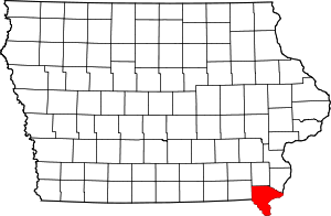 | |
| Townships | ||
| CDP | ||
| Other unincorporated communities | ||