Pilot Grove, Iowa
| Pilot Grove, Iowa | |
|---|---|
| Unincorporated community | |
 Pilot Grove, Iowa Location within the state of Iowa | |
| Coordinates: 40°45′46″N 91°32′13″W / 40.76278°N 91.53694°WCoordinates: 40°45′46″N 91°32′13″W / 40.76278°N 91.53694°W | |
| Country | United States |
| State | Iowa |
| County | Lee |
| Elevation | 643 ft (196 m) |
| Time zone | UTC-6 (Central (CST)) |
| • Summer (DST) | UTC-5 (CDT) |
| ZIP codes | 52648 |
| GNIS feature ID | 460145[1] |
Pilot Grove is an unincorporated community in northern Lee County, Iowa, United States. It lies along local roads northwest of the city of Fort Madison, the county seat of Lee County.[2] Its elevation is 643 feet (196 m).[1] Although Pilot Grove is unincorporated, it has a post office, with the ZIP code of 52648,[3] which opened on May 1, 1837. There has not always been a Pilot Grove post office since that date: it was discontinued on June 30, 1894, and when it was reestablished on August 7, 1895, it was under the name of Overton. The name was not restored to Pilot Grove until March 19, 1908.[4]
Pilot Grove was laid out in 1858.[5]
Pilot Grove is part of the Fort Madison–Keokuk, IA-MO Micropolitan Statistical Area.
References
- 1 2 "Pilot Grove, Iowa". Geographic Names Information System. United States Geological Survey.
- ↑ Rand McNally. The Road Atlas '08. Chicago: Rand McNally, 2008, p. 39.
- ↑ Zip Code Lookup
- ↑ U.S. Geological Survey Geographic Names Information System: Pilot Grove Post Office
- ↑ The History of Lee County, Iowa. Western Historical Company. 1879. p. 679.
Municipalities and communities of Lee County, Iowa, United States | ||
|---|---|---|
| Cities | 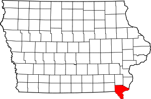 | |
| Townships | ||
| CDP | ||
| Other unincorporated communities | ||
This article is issued from
Wikipedia.
The text is licensed under Creative Commons - Attribution - Sharealike.
Additional terms may apply for the media files.