Sint Anthonis
| Sint Anthonis | |||
|---|---|---|---|
| Municipality | |||
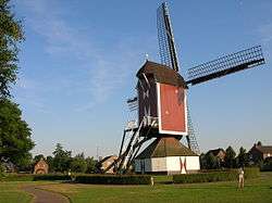 Windmill in Oploo | |||
| |||
.svg.png) Location in North Brabant | |||
| Coordinates: 51°38′N 5°53′E / 51.633°N 5.883°ECoordinates: 51°38′N 5°53′E / 51.633°N 5.883°E | |||
| Country | Netherlands | ||
| Province | North Brabant | ||
| Government[1] | |||
| • Body | Municipal council | ||
| • Mayor | Marleen Sijbers (VVD) | ||
| Area[2] | |||
| • Total | 99.76 km2 (38.52 sq mi) | ||
| • Land | 99.26 km2 (38.32 sq mi) | ||
| • Water | 0.50 km2 (0.19 sq mi) | ||
| Elevation[3] | 18 m (59 ft) | ||
| Population (August 2017)[4] | |||
| • Total | 11,582 | ||
| • Density | 117/km2 (300/sq mi) | ||
| Time zone | UTC+1 (CET) | ||
| • Summer (DST) | UTC+2 (CEST) | ||
| Postcode | 5445–5446, 5449, 5840–5846 | ||
| Area code | 0485 | ||
| Website |
www | ||


Sint Anthonis (![]()
History
The town was mentioned in a last will as early as 1312. The town was called Oelbroec at the time. As the church of St. Anthony The Abbot was completed in 1477, people started referring to the town as the "Parish of St. Anthony in Oelbroec", and by 1570 the name Oelbroec had disappeared. Church Book registration started in 1640 and are to be found on the BHIC web site.
Population centres
- Landhorst
- Ledeacker
- Oploo
- Rijkevoort
- De Walsert
- Sint Anthonis
- Stevensbeek
- Wanroij
- Westerbeek
Topography
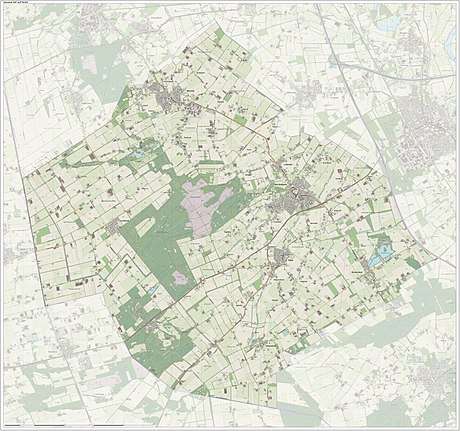
Dutch Topographic map of the municipality of Sint Anthonis, June 2015
References
- ↑ "Samenstelling college van B&W" [Members of the board of mayor and aldermen] (in Dutch). Gemeente Sint Anthonis. Retrieved 3 June 2014.
- ↑ "Kerncijfers wijken en buurten" [Key figures for neighbourhoods]. CBS Statline (in Dutch). CBS. 2 July 2013. Retrieved 12 March 2014.
- ↑ "Postcodetool for 5845BH". Actueel Hoogtebestand Nederland (in Dutch). Het Waterschapshuis. Retrieved 3 June 2014.
- ↑ "Bevolkingsontwikkeling; regio per maand" [Population growth; regions per month]. CBS Statline (in Dutch). CBS. 27 October 2017. Retrieved 27 October 2017.
External links

- Official website
Places adjacent to Sint Anthonis | ||||||||||
|---|---|---|---|---|---|---|---|---|---|---|
| ||||||||||

This article is issued from
Wikipedia.
The text is licensed under Creative Commons - Attribution - Sharealike.
Additional terms may apply for the media files.