Cranendonck
| Cranendonck | |||
|---|---|---|---|
| Municipality | |||
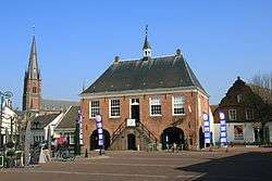 Former city hall of Budel | |||
| |||
.svg.png) Location in North Brabant | |||
| Coordinates: 51°18′N 5°35′E / 51.300°N 5.583°ECoordinates: 51°18′N 5°35′E / 51.300°N 5.583°E | |||
| Country | Netherlands | ||
| Province | North Brabant | ||
| Established | 1 January 1997[1] | ||
| Government[2] | |||
| • Body | Municipal council | ||
| • Mayor | Henri de Wijkerslooth de Weerdesteijn (acting) (VVD) | ||
| Area[3] | |||
| • Total | 78.05 km2 (30.14 sq mi) | ||
| • Land | 76.45 km2 (29.52 sq mi) | ||
| • Water | 1.60 km2 (0.62 sq mi) | ||
| Elevation[4] | 28 m (92 ft) | ||
| Population (August 2017)[5] | |||
| • Total | 20,674 | ||
| • Density | 270/km2 (700/sq mi) | ||
| Time zone | UTC+1 (CET) | ||
| • Summer (DST) | UTC+2 (CEST) | ||
| Postcode | 6020–6028 | ||
| Area code | 0495 | ||
| Website |
www | ||


Cranendonck (pronounced [ˈkraːnə(n)dɔŋk] (![]()
Population centres
- Budel
- Budel-Dorplein
- Budel-Schoot
- Gastel
- Heikant, Gastel
- Maarheeze
- Soerendonk
Topography
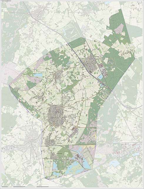
Dutch topographic map of the municipality of Cranendonck, June 2015
References
- ↑ "Gemeentelijke indeling op 1 januari 1997" [Municipal divisions on 1 January 1997]. cbs.nl (in Dutch). CBS. Retrieved 8 May 2014.
- ↑ "Wie is wie" [Who is who] (in Dutch). Gemeente Cranendonck. Archived from the original on 25 April 2014. Retrieved 8 May 2014.
- ↑ "Kerncijfers wijken en buurten" [Key figures for neighbourhoods]. CBS Statline (in Dutch). CBS. 2 July 2013. Retrieved 12 March 2014.
- ↑ "Postcodetool for 6027RK". Actueel Hoogtebestand Nederland (in Dutch). Het Waterschapshuis. Retrieved 8 May 2014.
- ↑ "Bevolkingsontwikkeling; regio per maand" [Population growth; regions per month]. CBS Statline (in Dutch). CBS. 27 October 2017. Retrieved 27 October 2017.
External links

- Official website
Places adjacent to Cranendonck | ||||||||||
|---|---|---|---|---|---|---|---|---|---|---|
| ||||||||||

This article is issued from
Wikipedia.
The text is licensed under Creative Commons - Attribution - Sharealike.
Additional terms may apply for the media files.