Oisterwijk
| Oisterwijk | |||
|---|---|---|---|
| Municipality | |||
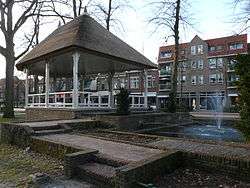 Gazebo in Oisterwijk | |||
| |||
.svg.png) Location in North Brabant | |||
| Coordinates: 51°35′N 5°12′E / 51.583°N 5.200°ECoordinates: 51°35′N 5°12′E / 51.583°N 5.200°E | |||
| Country | Netherlands | ||
| Province | North Brabant | ||
| Government[1] | |||
| • Body | Municipal council | ||
| • Mayor | Hans Janssen (CDA) | ||
| Area[2] | |||
| • Total | 65.13 km2 (25.15 sq mi) | ||
| • Land | 63.93 km2 (24.68 sq mi) | ||
| • Water | 1.20 km2 (0.46 sq mi) | ||
| Elevation[3] | 10 m (30 ft) | ||
| Population (August 2017)[4] | |||
| • Total | 26,101 | ||
| • Density | 408/km2 (1,060/sq mi) | ||
| Demonym(s) | Oisterwijker | ||
| Time zone | UTC+1 (CET) | ||
| • Summer (DST) | UTC+2 (CEST) | ||
| Postcode | 5059–5066 | ||
| Area code | 013 | ||
| Website |
oisterwijk | ||


Oisterwijk (Dutch pronunciation: [ˈoːstərˌʋɛik] (![]()
Population centres
- Heukelom
- Moergestel
- Oisterwijk
Topography
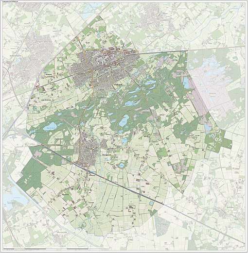
Dutch Topographic map of the municipality of Oisterwijk, June 2015
Transportation
- Railway station: Oisterwijk
City
Oisterwijk received city rights in 1230. Part of the municipality of Oisterwijk includes the 'Oisterwijkse bossen en vennen' (Oisterwijk forests and fens) and the 'Kampina'. Both are nature reserves of outstanding natural beauty. The reserves are owned and kept by the 'Vereniging Natuurmonumenten' (Nature Monuments Society).
References
- ↑ "Samenstelling college" [Members of the board] (in Dutch). Gemeente Oisterwijk. Retrieved 2 June 2014.
- ↑ "Kerncijfers wijken en buurten" [Key figures for neighbourhoods]. CBS Statline (in Dutch). CBS. 2 July 2013. Retrieved 12 March 2014.
- ↑ "Postcodetool for 5061HX". Actueel Hoogtebestand Nederland (in Dutch). Het Waterschapshuis. Retrieved 2 June 2014.
- ↑ "Bevolkingsontwikkeling; regio per maand" [Population growth; regions per month]. CBS Statline (in Dutch). CBS. 27 October 2017. Retrieved 27 October 2017.
External links

- Official website
Places adjacent to Oisterwijk | ||||||||||
|---|---|---|---|---|---|---|---|---|---|---|
| ||||||||||

This article is issued from
Wikipedia.
The text is licensed under Creative Commons - Attribution - Sharealike.
Additional terms may apply for the media files.