Etten-Leur
| Etten-Leur | |||
|---|---|---|---|
| Municipality | |||
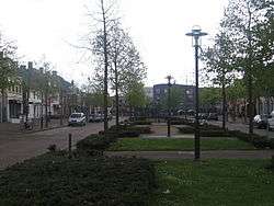 Street (Markt) in Etten-Leur | |||
| |||
.svg.png) Location in North Brabant | |||
| Coordinates: 51°34′N 4°38′E / 51.567°N 4.633°ECoordinates: 51°34′N 4°38′E / 51.567°N 4.633°E | |||
| Country | Netherlands | ||
| Province | North Brabant | ||
| Government[1] | |||
| • Body | Municipal council | ||
| • Mayor | Miranda de Vries (PvdA) | ||
| Area[2] | |||
| • Total | 55.92 km2 (21.59 sq mi) | ||
| • Land | 55.36 km2 (21.37 sq mi) | ||
| • Water | 0.56 km2 (0.22 sq mi) | ||
| Elevation[3] | 8 m (26 ft) | ||
| Population (August 2017)[4] | |||
| • Total | 43,382 | ||
| • Density | 784/km2 (2,030/sq mi) | ||
| Time zone | UTC+1 (CET) | ||
| • Summer (DST) | UTC+2 (CEST) | ||
| Postcode | 4870–4879 | ||
| Area code | 076 | ||
| Website |
www | ||


Etten-Leur (![]()
History
Both towns, created in the Middle Ages, were relatively prosperous during the period of the Dutch Republic, the exception being the period of the Eighty Years' War in which the area was a major battleground. This prosperity was caused by the fact that Etten was a centre for the production of peat, and Leur was a local trading port, as it had a harbour.
Decline in economic importance marked both towns during the nineteenth century. During this time the painter Vincent van Gogh briefly lived in Etten, making him the most famous citizen in the history of Etten and Leur. During World War II, the two towns were freed from German occupation in late October 1944 by elements of the U.S. 104th Infantry Division.
The economic decline was halted when, in 1950, the Dutch government decided to encourage population growth and industrial development. As a result of this development, both towns have grown towards each other and merged into one: Etten-Leur.
Notable residents have included the previously mentioned Vincent van Gogh.
Gallery
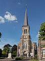 Church: de Sint Lambertuskerk
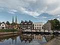 Port: de Leurse Haven
 Windmill: de Zwartenbergse molen
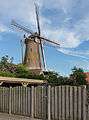 Windmill in modern quarter
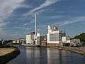 Factory (Hill's Pet Nutrition Manufacturing BV) at de Mark
Transportation
Topography
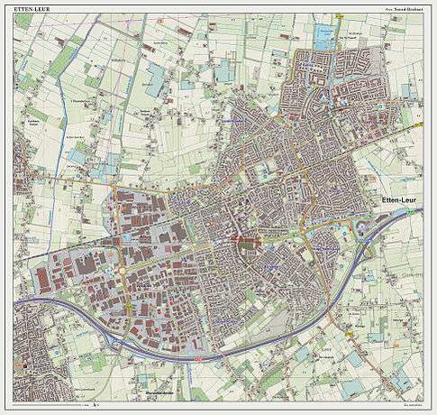
Dutch topographic map of Etten-Leur (town), March 2014
Education
- Katholieke Scholengemeenschap Etten-Leur, a Catholic high school
- Munnikenheide College
References
Notes
- ↑ "Het college van burgemeester en wethouders" [The board of mayor and aldermen] (in Dutch). Gemeente Etten-Leur. Retrieved 4 January 2018.
- ↑ "Kerncijfers wijken en buurten" [Key figures for neighbourhoods]. CBS Statline (in Dutch). CBS. 2 July 2013. Retrieved 12 March 2014.
- ↑ "Postcodetool for 4875AA". Actueel Hoogtebestand Nederland (in Dutch). Het Waterschapshuis. Retrieved 14 May 2014.
- ↑ "Bevolkingsontwikkeling; regio per maand" [Population growth; regions per month]. CBS Statline (in Dutch). CBS. 27 October 2017. Retrieved 27 October 2017.
Sources
- Information about the history of Etten-Leur has been retrieved from the Regional Archive of Western Brabant
External links

- Official website
Places adjacent to Etten-Leur | ||||||||||
|---|---|---|---|---|---|---|---|---|---|---|
| ||||||||||
