Drimmelen
| Drimmelen | ||
|---|---|---|
| Municipality | ||
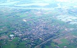 Aerial photo of Made | ||
| ||
.svg.png) Location in North Brabant | ||
| Coordinates: 51°41′N 4°48′E / 51.683°N 4.800°ECoordinates: 51°41′N 4°48′E / 51.683°N 4.800°E | ||
| Country | Netherlands | |
| Province | North Brabant | |
| Government[1] | ||
| • Body | Municipal council | |
| • Mayor | Gert de Kok (PvdA) | |
| Area[2] | ||
| • Total | 119.43 km2 (46.11 sq mi) | |
| • Land | 96.13 km2 (37.12 sq mi) | |
| • Water | 23.30 km2 (9.00 sq mi) | |
| Elevation[3] | 3 m (10 ft) | |
| Population (August 2017)[4] | ||
| • Total | 26,992 | |
| • Density | 281/km2 (730/sq mi) | |
| Time zone | UTC+1 (CET) | |
| • Summer (DST) | UTC+2 (CEST) | |
| Postcode | 4844–4845, 4920–4927 | |
| Area code | 0162 | |
| Website |
www | |

Drimmelen (![]()
Population centres
Towns:
- Made (population: 11,710)
- Terheijden (6,410)
- Lage Zwaluwe (4,060)
- Wagenberg (2,250)
- Hooge Zwaluwe (1,670)
- Drimmelen (570)
Hamlets (population data concerning these hamlets are included in the population data of the towns near which they are located):
- Blauwe Sluis
- Oud-Drimmelen
- Helkant
Topography
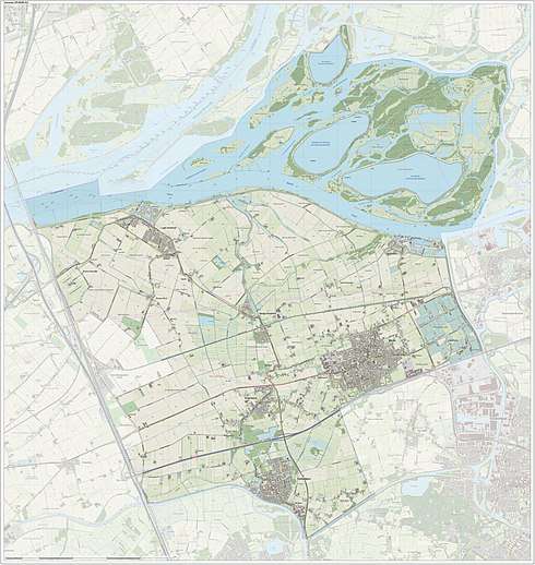
Dutch Topographic map of the municipality of Drimmelen, June 2015.
Transportation
The Lage Zwaluwe railway station is situated on the Breda–Rotterdam railway and the railway to Roosendaal.
References
- ↑ "Collegeleden" [Board members] (in Dutch). Gemeente Drimmelen. Retrieved 10 May 2014.
- ↑ "Kerncijfers wijken en buurten" [Key figures for neighbourhoods]. CBS Statline (in Dutch). CBS. 2 July 2013. Retrieved 12 March 2014.
- ↑ "Postcodetool for 4921BV". Actueel Hoogtebestand Nederland (in Dutch). Het Waterschapshuis. Retrieved 11 May 2014.
- ↑ "Bevolkingsontwikkeling; regio per maand" [Population growth; regions per month]. CBS Statline (in Dutch). CBS. 27 October 2017. Retrieved 27 October 2017.
External links

- Official Website
Places adjacent to Drimmelen | ||||||||||
|---|---|---|---|---|---|---|---|---|---|---|
| ||||||||||

This article is issued from
Wikipedia.
The text is licensed under Creative Commons - Attribution - Sharealike.
Additional terms may apply for the media files.