St. Anne Township, Kankakee County, Illinois
| Saint Anne Township | |
|---|---|
| Township | |
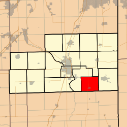 Location in Kankakee County | |
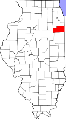 Kankakee County's location in Illinois | |
| Coordinates: 41°02′38″N 87°42′58″W / 41.04389°N 87.71611°WCoordinates: 41°02′38″N 87°42′58″W / 41.04389°N 87.71611°W | |
| Country | United States |
| State | Illinois |
| County | Kankakee |
| Established | March 11, 1857 |
| Government | |
| • Supervisor | Karie Witvoet |
| Area | |
| • Total | 30.3 sq mi (78 km2) |
| • Land | 30.26 sq mi (78.4 km2) |
| • Water | 0.04 sq mi (0.1 km2) 0.13% |
| Elevation | 640 ft (195 m) |
| Population (2010) | |
| • Estimate (2016)[1] | 2,110 |
| • Density | 72.4/sq mi (28.0/km2) |
| Time zone | UTC-6 (CST) |
| • Summer (DST) | UTC-5 (CDT) |
| ZIP codes | 60954, 60964 |
| FIPS code | 17-091-66651 |
Saint Anne Township is one of seventeen townships in Kankakee County, Illinois, USA. As of the 2010 census, its population was 2,191 and it contained 943 housing units.[2] The township was created on March 11, 1857 from parts of Aroma Township.
Geography
According to the 2010 census, the township has a total area of 30.3 square miles (78 km2), of which 30.26 square miles (78.4 km2) (or 99.87%) is land and 0.04 square miles (0.10 km2) (or 0.13%) is water.[2]
Cities, towns, villages
Adjacent townships
- Ganeer Township (north)
- Pembroke Township (east)
- Beaverville Township, Iroquois County (southeast)
- Papineau Township, Iroquois County (southwest)
- Aroma Township (northwest)
Major highways
Lakes
- Cote Lake
Demographics
| Historical population | |||
|---|---|---|---|
| Census | Pop. | %± | |
| Est. 2016 | 2,110 | [1] | |
| U.S. Decennial Census[3] | |||
Government
The township is governed by an elected Town Board of a supervisor and four trustees. The township also has an elected assessor, clerk, highway commissioner and supervisor. The township Office is located at 471 West Sheffield, St. Anne, IL 60964.
Political districts
- Illinois' 11th congressional district
- State House District 79
- State Senate District 40
School districts
- St. Anne Community Consolidated School District 256
- St. Anne Community High School District 302
References
- "St. Anne Township, Kankakee County, Illinois". Geographic Names Information System. United States Geological Survey. Retrieved 2010-02-20.
- United States Census Bureau 2007 TIGER/Line Shapefiles
- United States National Atlas
- 1 2 "Population and Housing Unit Estimates". Retrieved June 9, 2017.
- 1 2 "Population, Housing Units, Area, and Density: 2010 - County -- County Subdivision and Place -- 2010 Census Summary File 1". United States Census. Retrieved 2013-05-28.
- ↑ "Census of Population and Housing". Census.gov. Retrieved June 4, 2016.
External links
- Village of St. Anne official site
- Kankankee County Official Site
- City-Data.com
- Illinois State Archives
Municipalities and communities of Kankakee County, Illinois, United States | ||
|---|---|---|
| Cities | ||
| Villages | ||
| Townships | ||
| Unincorporated communities |
| |
| Footnotes | ‡This populated place also has portions in an adjacent county or counties | |
This article is issued from
Wikipedia.
The text is licensed under Creative Commons - Attribution - Sharealike.
Additional terms may apply for the media files.